Cycling Colombia Part 3: Medellín to Ibagué
26 May - 1 July 2024
26 May - Medellín to La Pintada (45.2 mi, 72.7 km)
27 May - Rest Day in La Pintada
28 May - La Pintada to La Felisa (29.7 mi, 47.8 km)
29 May - La Felisa to La Estrella (15.0 mi, 24.1 km)
30 May - La Estrella to Chinchiná (21.6 mi, 34.8 km)
31 May - Chinchiná to Pereira (17.6 mi, 28.3 km)
1-3 June - Layover in Pereira
4 June - Pereira to Salento (23.3 mi, 37.5 km)
5-7 June - Layover in Salento
8 June - Salento to Toche (30.7 mi, 49.4 km)
9 June - Rest Day in Toche
10 June - Toche to Cajamarca (14.8 mi, 23.8 km)
11 June - Cajamarca to Ibagué (20.4 mi, 32.8 km)
12 June-1 July - Festival Layover in Ibagué
Where do all the Colombian cyclists go?
During our stay in Medellín we had participated in Ciclovía - a weekly event held in many Colombian cities where roads are closed to traffic on Sunday mornings, so people can get out and ride bikes, walk and get other forms of exercise. As the name implies, the ciclovías got their start as a way to offer people a car-free space for cycling. So we were somewhat surprised that 90% of the people we saw on the Medellín ciclovía were not cyclists. The vast majority were strolling, running, and walking their dogs. In a country that is famous for its bicycle-crazy population, where were all the cyclists?
Apparently the ciclovía, at least in Medellín, is a little bit too tame for Colombia’s serious cycling enthusiasts. Instead, they are on the open roads outside of town, tackling mountains that would put cyclists from many other countries to shame.
We discovered this on our departure from Medellín. Scarred by the trauma of the insane traffic we had battled when we entered the city, we made the sensible decision to depart on a Sunday morning. That way we could take advantage of the roads closed for ciclovía, as well as the lighter Sunday traffic, to have a more enjoyable exit from the city.
We had a very big day of cycling planned - especially since we had been off the bikes for more than a week (which meant we had lost some of the conditioning we gained climbing the mountains to get to Medellín). During the first 18 miles (29 km) we would steadily climb 4,000 ft (1,220 m) out of the valley. To us, it seemed like a major undertaking. But for many of Medellín’s cyclists, it was just another Sunday.
As we departed our hotel, we once again noticed that there were only a few cyclists on the ciclovía. But as we got closer to the edge of the city, we encountered more and more cyclists. Pretty soon we were traveling in a small river of bicycles. Like us, they used the ciclovía to ride out of the city, where the real cycling action took place on the steep mountain roads.
It was amazing. We had never seen so many cyclists on one road, outside of organized events. There were literally hundreds of people cycling up the 18 mile, 4,000 foot mountain like it was just another weekend ride. Many of them went all the way to the top of the ridge, before turning around and heading back down to the city. With these high mountains to ride, it’s no wonder Columbia has been making such large contributions to pro cycling, especially for the size of the country. A surprising number of vendors - ranging from small, temporary fruit stands to bigger restaurants - had set up shop along the route to cater to the steady stream of cycling customers.
An early morning view back towards the city, as we climbed our way out of the Aburrá Valley. Medellín, Antioquia Department, Colombia. Copyright © 2019-2024 Pedals and Puffins.
Of course, the Colombian cyclists were mostly on ultralight road and mountain bikes, as opposed to our heavy expedition bikes with 50 lbs (23 kg) of gear. So most of them zipped past us with cheerful shouts of “buenos días!” For us, however, it was a much longer duration climb. At one point we took a break on the side of the road, and PedalingGal sat down to rest and catch her breath. She must have looked like she could use a boost, because a local cyclist went up the road and bought a couple of bananas from a little fruit stand, then brought them back to us. It was a very welcome gift, and helped give us the energy to continue.
It took us five hours to finally reach the top of the ridge, called Alto de Minas. At the summit, we stopped for an extended break at a small restaurant frequented by other cyclists. It was awesome to sit in the shade, rehydrate, and recover from the effort of the climb. The folks who ran the shop - Emanuel and Marta - were incredibly sweet, and chatted with us about our trip. One of their nieces was visiting, and they were very proud of the fact that she was taking English in school. They encouraged her to try to speak with us, but she was pretty shy and we didn’t get too far past, “hello, how are you?” Even so, her aunt and uncle beamed when she spoke.
The road from Medellín to Alto de Minas was a very popular cycling route. Even the little restaurant at the top of the ridge had this sign with some stats of interest to cyclists. Alto de Minas, Antioquia Department, Colombia. Copyright © 2019-2024 Pedals and Puffins.
The 27 mile descent (43.5 km) on the far side of the ridge was a nice reprieve, with some gorgeous views of the mountains and valleys. It took a bit longer than expected, though. Our pace was slowed by the fact that the road was quite narrow, with hardly any shoulder, and a lot of heavy truck traffic had started up in the afternoon. We frequently pulled over to let our brakes cool, to let trucks pass, or to let the air clear from slow-moving vehicles spouting black fumes. It took us another 2.5 hours to finally arrive in La Pintada (pop. 7,000).
View of the Andes Mountains towards the heart of Colombia’s coffee country. The town of Fredonia, which sits near the base of the two, distant peaks in the center, is famous as the home of the coffee brand Juan Valdez. Versalles, Antioquia Department, Colombia. Copyright © 2019-2024 Pedals and Puffins.
The main road through town was quite lively with businesses that catered to travelers passing through - including a very high proportion of restaurants and bakeries. Other than that, La Pintada felt like a small, rural town. The main square was fairly quiet. And a large corral that looked like the site of a pretty big cattle auction sat quiet on a Monday morning.
A mural on a highway underpass celebrated plants and animals of the region. La Pintada, Antioquia Department, Colombia. Copyright © 2019-2024 Pedals and Puffins.
This mural shows traditional fishermen in the early morning light. Although fish is a common menu item, these days most of it comes from fish farms. La Pintada, Antioquia Department, Colombia. Copyright © 2019-2024 Pedals and Puffins.
The central plaza had a María Mulata statue (a.k.a., great-tailed grackle), very reminiscent of the one we saw in Cartagena - probably by the same artist. La Pintada, Antioquia Department, Colombia. Copyright © 2019-2024 Pedals and Puffins.
Straw hats are popular for sun protection in Colombia. But one type of hat stands out from the others. The Sombrero Vueltiao - woven in distinctive black and white patterns with upturned ‘wings’ on the sides - is actually one of Colombia’s official national symbols. This display at our hotel showed off a number of these distinctive hats. La Pintada, Antioquia Department, Colombia. Copyright © 2019-2024 Pedals and Puffins.
Reunion with the Cauca River
The Cauca is an ancient river, pre-dating the geologic rise of the Andes Mountains. As tectonic forces slowly buckled the earth along the Pacific Ring of Fire, the Cauca River continued to flow, cutting a narrow gap through the mountains as they pushed ever higher. As a result, for several hundred miles the Cauca River flows through a deep canyon that doesn’t contain any large human settlements. The Cauca Canyon remains one of the more sparsely-inhabited regions in Colombia.
On our way to Medellín, we had cycled along the banks of the Cauca River, before beginning our big ascent into the mountains. But we had turned away from the river as it entered the most remote, forbidding and unrideable part of the canyon.
Now, in the town of La Pintada, we were reunited with the upper reaches of the Cauca River. La Pintada sits on the banks of the river just above where it enters the deep canyon. Upstream from here, the mountains melted away into a more mellow, highland valley.
A view of the Cauca River, just upstream from La Pintada. A few miles downstream the river enters a narrow canyon. But we cycled upstream through this wide, scenic valley. Cauca River, South of La Pintada, Antioquia Department, Colombia. Copyright © 2019-2024 Pedals and Puffins.
An overnight rainstorm seemed to have soaked these black vultures. They were lined up on jersey barriers, trying to dry out in the morning sun. South of La Pintada, Antioquia Department, Colombia. Copyright © 2019-2024 Pedals and Puffins.
In some places cliffs towered above the river. A local legend says that if you wander among the cliffs, you can hear mysterious bells ringing. Los Farallones, South of La Pintada, Antioquia Department, Colombia. Copyright © 2019-2024 Pedals and Puffins.
After a stormy night, we had a gorgeous day for cycling. La Marina, Antioquia Department, Colombia. Copyright © 2019-2024 Pedals and Puffins.
In some places the river narrowed, forming coffee-colored rapids. Cauca River, La Marina, Antioquia Department, Colombia. Copyright © 2019-2024 Pedals and Puffins.
The streams flowing out of the mountains here were not pristine. Most were muddy from upstream erosion. But this stream stood out for its disconcertingly dark gray water. Upstream was one of Colombia’s larger gold mines, operated by a Canadian company. La Garucha, Caldas Department, Colombia. Copyright © 2019-2024 Pedals and Puffins.
We arrived in the small settlement of La Felisa around noon, and debated whether or not to continue further up the road, since the terrain was pretty mellow. But the deciding factor was that the day had gotten very hot (90F/32C), and another couple of hours of cycling in the heat and humidity didn’t sound like fun. The roadside hotel in La Felisa had air conditioning, so we decided to stay. The rooms were tiny, but they were made of brick which kept them nice and cool (like a little cave). After a big lunch, we went back to the room and promptly fell asleep. Cycling in the heat takes a lot out of you.
El Playon was a typical roadside service center, with a very basic hotel and attached, open air restaurant. They’re nothing fancy, but provide everything we need for surprisingly little money. La Felisa, Caldas Department, Colombia. Copyright © 2019-2024 Pedals and Puffins.
The next day we awoke to overcast skies and heavy rain, which delayed our departure while we waited for the skies to clear. With a 9am departure we decided to keep the ride short. That allowed us to take it easy and enjoy the scenery.
Overnight rain created clouds that hugged the hillsides, obscuring the tops of the nearby mountains. South of La Felisa, Caldas Department, Colombia. Copyright © 2019-2024 Pedals and Puffins.
Our route took us through the La Felisa Tunnel (0.5 mi / 0.8 km long). Fortunately the traffic was light and the tunnel was well-lit. Caldas Department, Colombia. Copyright © 2019-2024 Pedals and Puffins.
Although the road shoulder was wide and paved, recent heavy rains causing small rockslides and slumping road banks often dumped rocks, dirt, and tree branches in our way - occasionally requiring us to ride out in the main traffic lane. Near Guerrero, Caldas Department, Colombia. Copyright © 2019-2024 Pedals and Puffins.
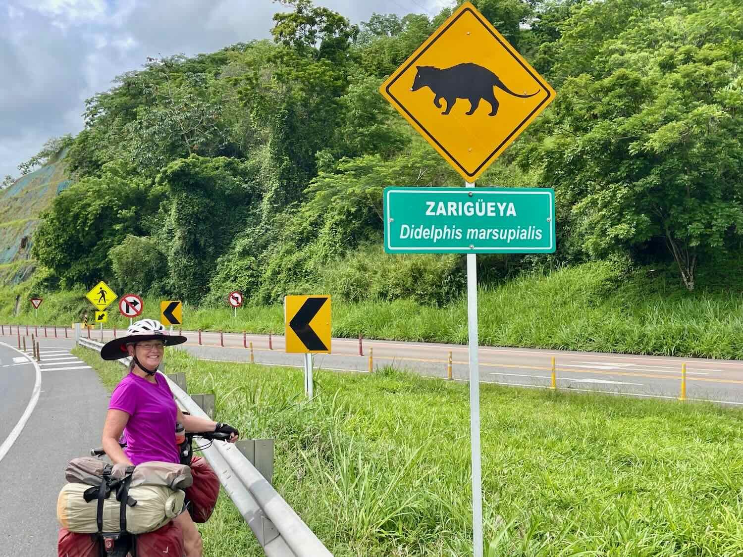
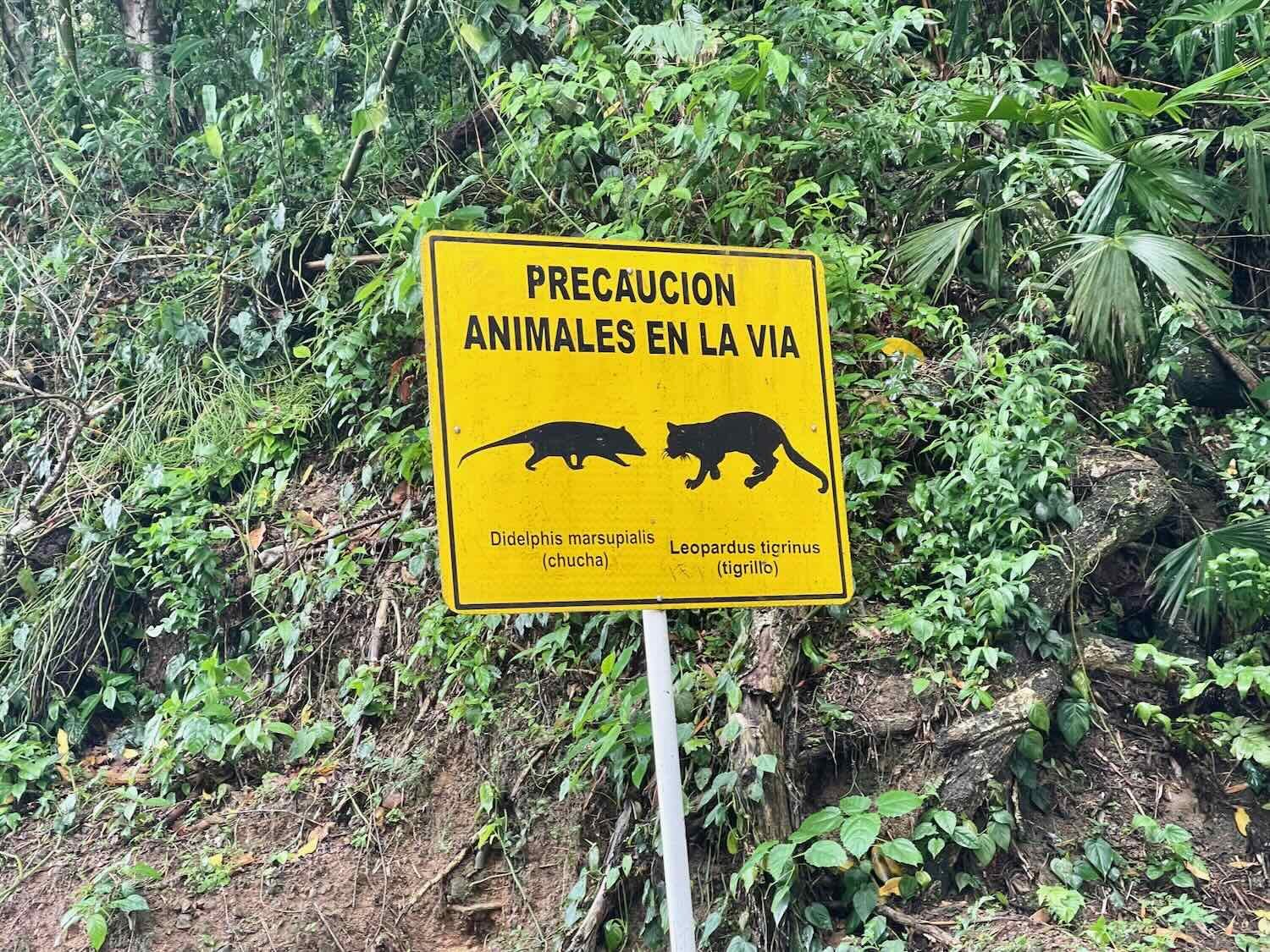
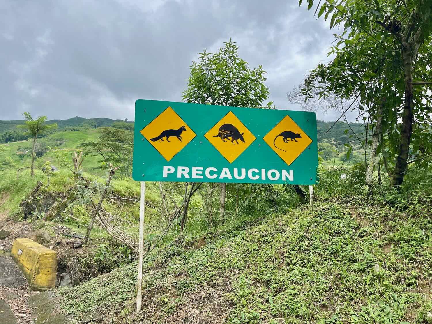
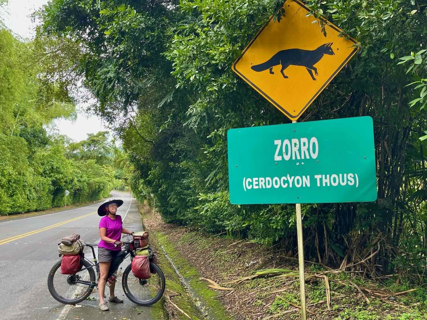
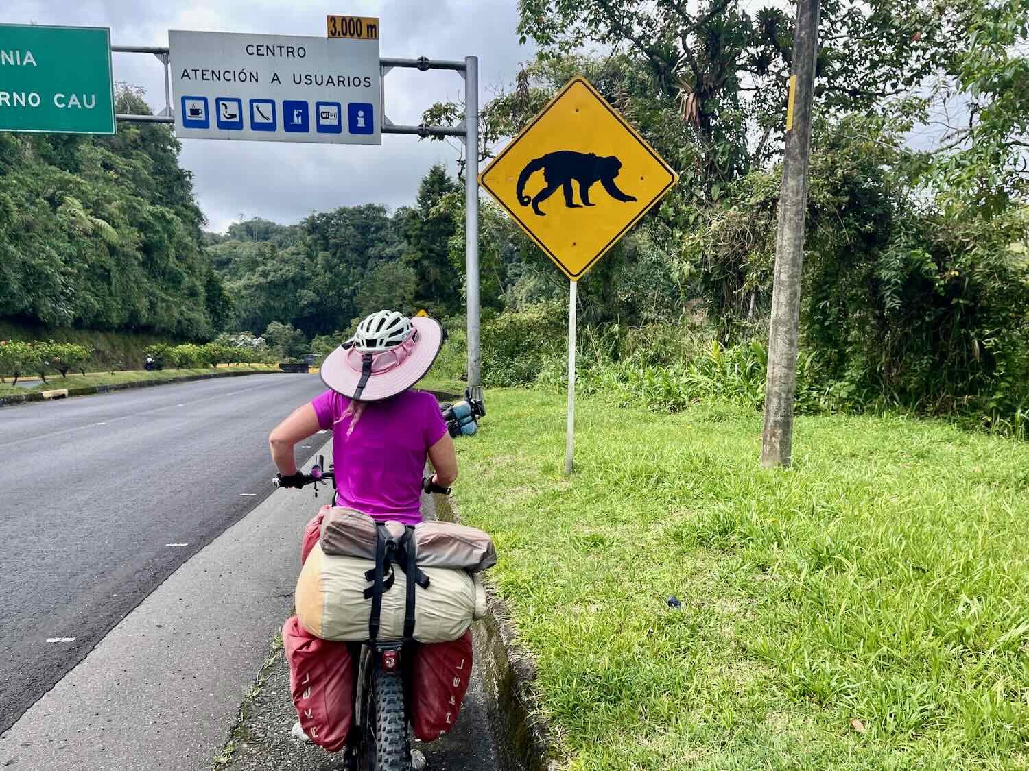
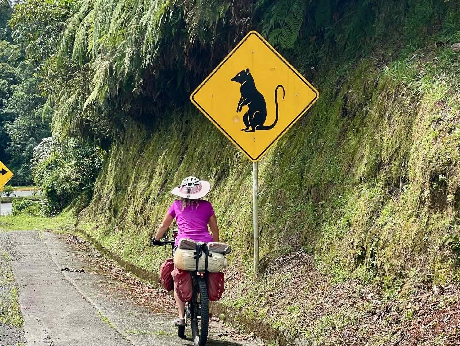
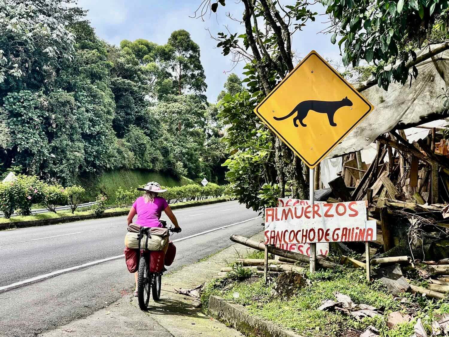
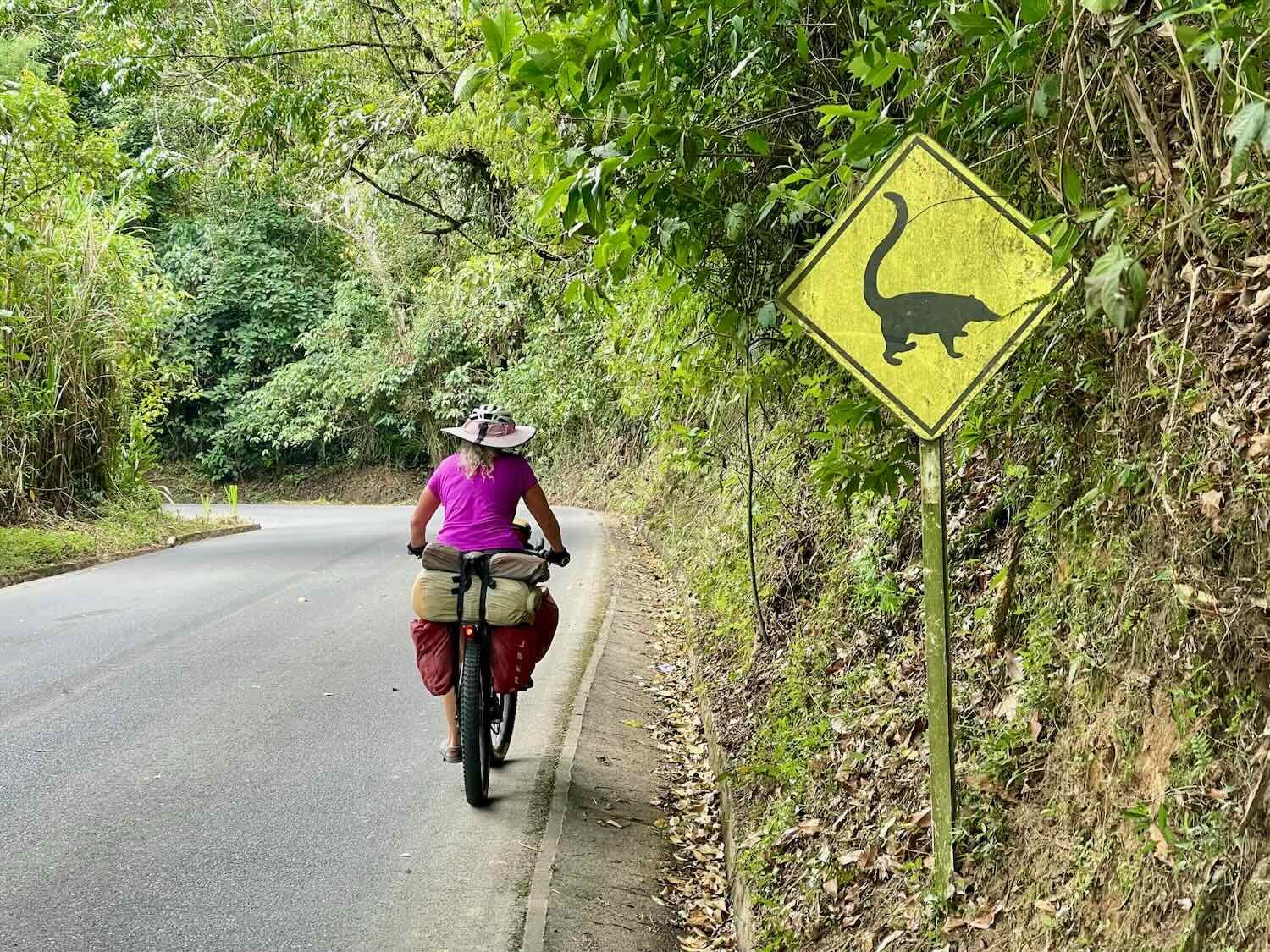
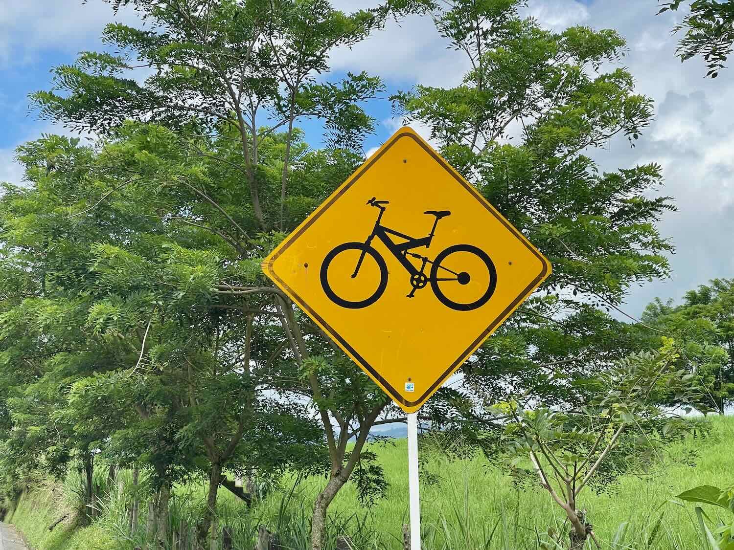
Over the years we’ve gotten a kick out of the various animal crossing signs that get posted along highways. This part of Colombia was particularly rich in road-crossing sign diversity. We were impressed that many of the signs included both the scientific and common names (in Spanish) of the animals - something we had never seen before. Others showed multiple species, including some interesting images of rare, wild felines. Below is a selection of some of the signs we encountered (over the course of several days of cycling).
About an hour and a half into the ride, we finally said, ‘goodbye’ to the Cauca River for the last time. From there, the river would head southwest towards the metropolis of Calí, while we would turn southeastward, towards another encounter with the mountains.
Our final view of the fabled Cauca River, near the town of Irra, Caldas Department, Colombia. Copyright © 2019-2024 Pedals and Puffins.
We were intrigued by this row of public phones at a highway service center. Although they look like old-fashioned pay phones, each one has an antenna - suggesting they might actually be cell phones in disguise. La Caucana Service Area, South of Irra, Caldas Department, Colombia. Copyright © 2019-2024 Pedals and Puffins.
The Hotel Botija was another, low budget, roadside accommodation. And even by budget hotel standards it was pretty basic. The rooms were some of the tiniest we’d ever seen. There was no way to fit two bikes in one room, no matter how creative we tried to be. So we ended up getting separate rooms. Even with just one bike per room, there was barely enough space to squeeze by and access the bathrooms (which didn’t have toilet seats). On the bright side, this little hotel actually had wifi (many of them do not). That made passing the time a lot easier and more productive.
Our dinner in the restaurant was very simple - just grilled meat and homemade fries. Part of their sales pitch was that the meat was prepared a la llanera - a slow-roasting method considered traditional in Colombia. Large cuts of meat are cooked very slowly on a spit, over charcoal, in a brick or clay oven. At the hotel restaurant, the oven was located right out front, with glass doors so that you could see the meat roasting. In the end the meat and fries were quite tasty, but the portions were small and it would have been nice to have some kind of vegetable to go with it. It didn’t feel like a very good value.
A glass door let restaurant patrons see the large cuts of meat slowly roasting on spits, over a wood fire. La Estrella, Caldas Department, Colombia. Copyright © 2019-2024 Pedals and Puffins.
As we left the Cauca River Valley behind, it was back to cycling uphill. Between La Estrella and the town of Chinchiná we would gain back more than 3,000 ft (915 m) of the elevation we had recently lost. Fortunately, the uphill gradient wasn’t that bad. So while the climb was long, it wasn’t punishing. We actually were quite happy that the weather was overcast with a little bit of a drizzle for most of the day. It felt pleasant as we labored back up into the mountains.
Not much seems to be known about this species of butterfly, the orange-barred pixie. The vast majority of observations are from the northern Andes and the Sierra Madre mountains of Central America, but there are also records from within the lowlands of the Amazon forest. Near La Finaria, Caldas Department, Colombia. Copyright © 2019-2024 Pedals and Puffins.
About 2.5 hours into the ride we stopped for breakfast at a roadside restaurant. Across the road was a sulfuric acid factory with a big, yellow pile of sulfur sitting out front. It looked odd, but apparently elemental sulfur isn’t dangerous to people. La Manuelito, Caldas Department, Colombia. Copyright © 2019-2024 Pedals and Puffins.
On the Colombian Coffee Route
Even though we had cycled near the homeland of ‘Juan Valdez’ a couple of days prior, it was only after passing through La Felisa that we officially joined the Ruta del Café (the ‘coffee route’) that goes through Colombia’s most productive coffee regions. Over the next several days of cycling we would see a lot of indications that we were in coffee country.
A sign indicated that the Coffee National Park was about 60 mi (92 km) up the road. South of La Manuelita, Caldas Department, Colombia. Copyright © 2019-2024 Pedals and Puffins.
A scenic stream flowed by the road. The hillside on the far left was covered with coffee bushes. Quebrada El Rosario, South of La Manuelita, Caldas Department, Colombia. Copyright © 2019-2024 Pedals and Puffins.
While most of the day’s ride had been fairly easy, our route saved the hardest part for last. The final mile into town was a slow grind up a 15% gradient. It seemed to last forever. This was certainly not the first time we’d had that happen - and it probably wouldn’t be the last. Some towns are just perched on the top of steep hills.
When we finally checked into a hotel near the central plaza, we were treated to something special - a hot shower! This was the first time we’d had hot water since leaving Medellín, and it was very welcome.
As a hub along the Ruta del Café, Chinchiná (pop. 48,000) is all about coffee. In the central plaza, coffee themed artwork abounds. An essential photo is the World’s Largest Coffee Cup - as certified by Guinness World Records in 2019. It took 50 people to build and fill this giant cup with 22,739 liters of coffee - that’s more than 96,000 regular cups!
The town’s ‘letras’ sign was, of course, decorated with images of coffee beans. Chinchiná, Caldas Department, Colombia. Copyright © 2019-2024 Pedals and Puffins.
And here it is… the world’s largest coffee cup. (Love the motmot image on the side). Chinchiná, Caldas Department, Colombia. Copyright © 2019-2024 Pedals and Puffins.
This mural was interesting, partly because it was so different from the typical, romantic scenes of farmers, indigenous people, plants and animals. Several generations of guys are simply gathered around a table to share a meal. Chinchiná, Caldas Department, Colombia. Copyright © 2019-2024 Pedals and Puffins.
Rounding out the art in the plaza, a giant sculpture of an iguana appeared to be climbing down out of one of the big trees. Chinchiná, Caldas Department, Colombia. Copyright © 2019-2024 Pedals and Puffins.
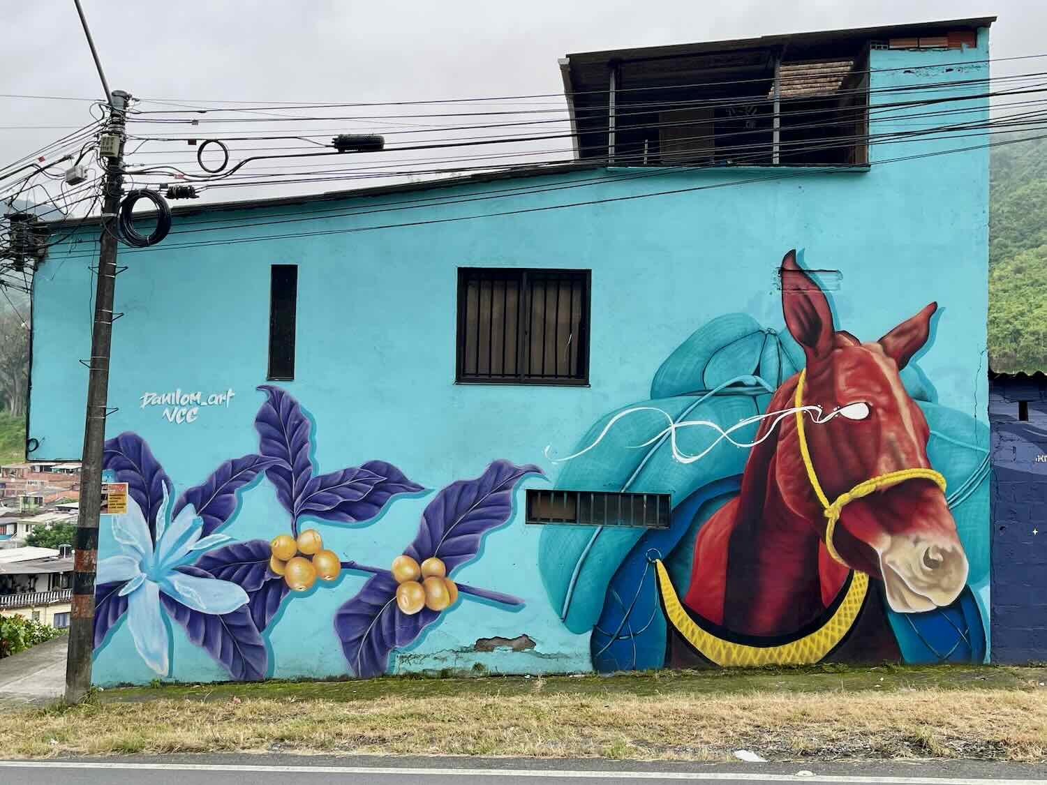
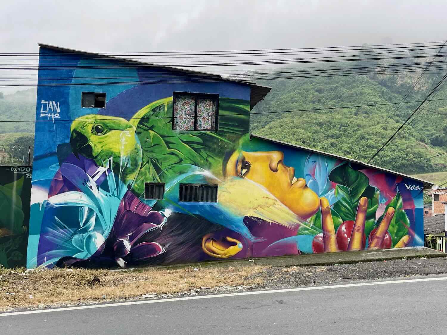
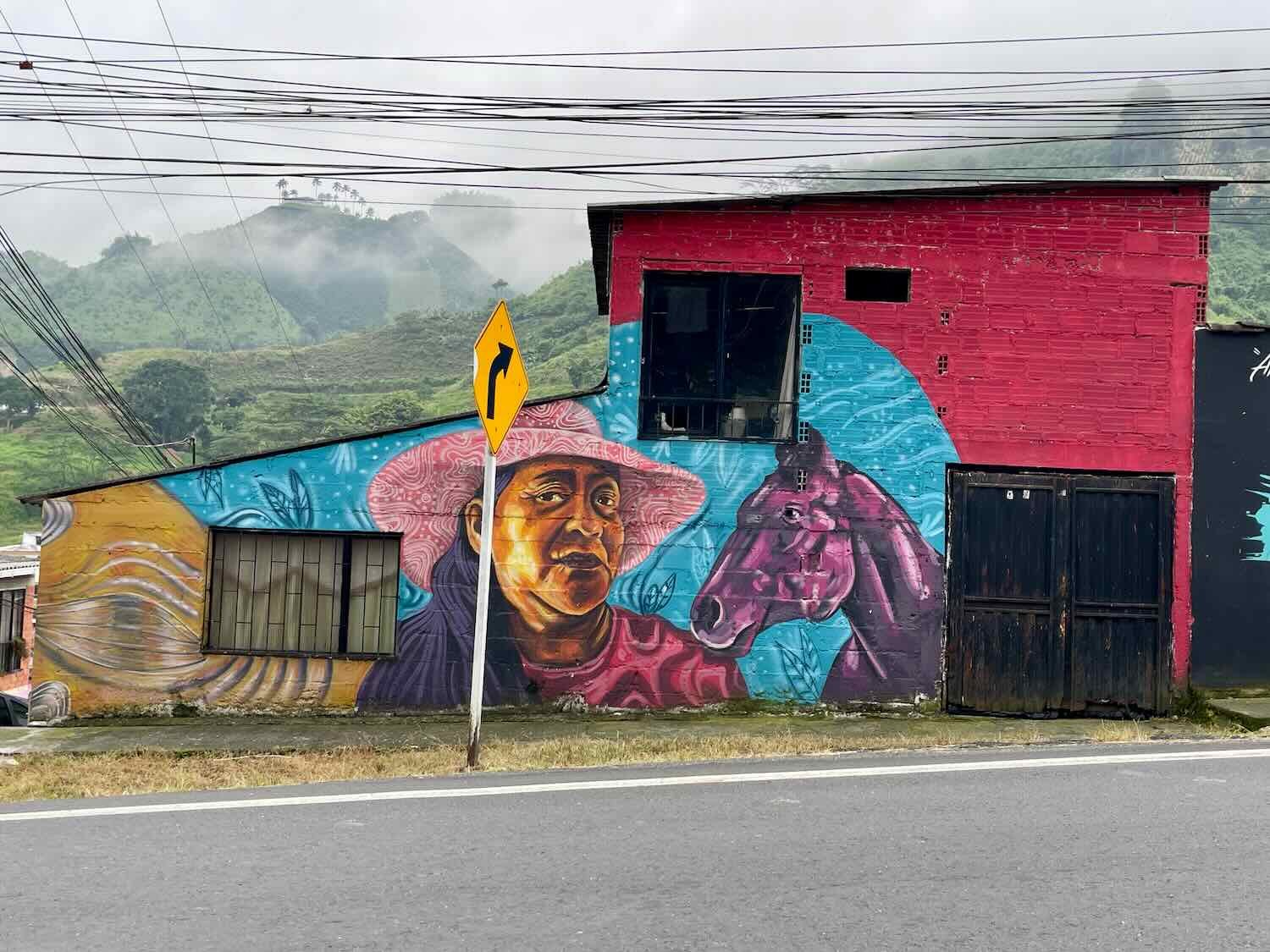
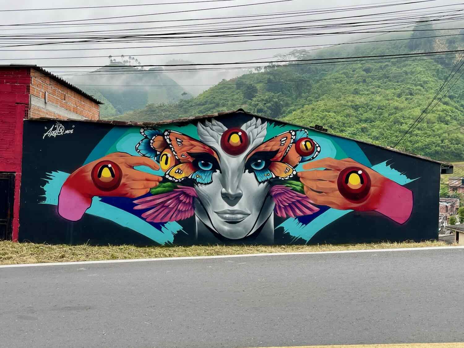
The next morning as we cycled out of town, we were treated to a spectacular site - a whole row of buildings that lined the road were painted with gorgeous murals. In 2022, the city of Chinchiná invited 50 mural artists from around the country (and one from Peru) to paint murals in several parts of the city, including along the road we were traveling. It was a feast for the eyes, and a great way to remember this charming city in coffee country.
The day’s ride went fairly quickly. We climbed steadily upwards through hillsides covered with coffee bushes for about 2.5 hours, then descended into a big metropolitan area.
The hillsides along our route between Chinchiná and Pereira were covered with coffee bushes, laden with green (unripe) coffee beans. Near Los Mangos, Caldas, Department, Colombia. Copyright © 2019-2024 Pedals and Puffins.
Halfway Across Colombia
Our hotel in Pereira (pop. 385,850) had a cool, 3-D relief map of Colombia hanging on the wall. On that map, it was easy to see how the Andes Mountains split into three different ranges in Colombia - like a giant bird’s foot with three toes facing northward. Our route had taken us across the flat northern plains, and then up through the high valleys that lie between the western and central ridges of mountains. From Pereira, we would cut eastward across the central range.
Tracing our route through Colombia. We’ve come about halfway across the country. Pereira, Risaralda Department, Colombia. Copyright © 2019-2024 Pedals and Puffins.
Ciclovía in Pereira
One morning when we headed out for a walk, we noticed that the big avenue we had used to cycle into town was closed, and packed with lots of runners, walkers and cyclists. It was Sunday, and that meant it was ciclovía day. We changed our plans, and walked for a couple of hours along the ciclovía. It turned out to be our favorite day in Pereira. Tons of people were out on the road enjoying a beautiful morning, including plenty of cyclists this time. We had a wonderful time participating in the communal fun.
Another Sunday, another ciclovía in Colombia. We walked more than five miles along the traffic-free boulevard, sharing a beautiful morning with crowds of locals. Pereira, Risaralda Department, Colombia. Copyright © 2019-2024 Pedals and Puffins.
One of the Go Rigo Go! stores owned by Colombian cycling legend Rigoberto Urán was near our hotel. Pereira, Risaralda Department, Colombia. Copyright © 2019-2024 Pedals and Puffins.
Along the ciclovía we passed the central terminal for the MegaCable - the skyway that’s part of the city’s transportation system. At 2.1 miles (3.4 km), it’s the longest single line among Colombia’s six cities with cable systems. (Medellín has the most individual lines.) These touristy-looking gondolas actually solve practical challenges by rapidly moving people from poorer, outlying areas into the city center, where jobs are more plentiful. Among city planners, these gondolas have become renowned. Unfortunately, other cities outside of Columbia have not been as successful justifying the construction of gondolas for public transport. Pereira, Risaralda Department, Colombia. Copyright © 2019-2024 Pedals and Puffins.
Vendors along the way sold fresh sugar cane juice to thirsty folks out on the ciclovía. They all had traditional, wooden trapiches to crush stalks of sugar cane on site. Perhaps cane juice tastes better made ‘the old way.’ Pereira, Risaralda Department, Colombia. Copyright © 2019-2024 Pedals and Puffins.
Other refreshments included freshly cut fruits - especially papaya, mango, watermelon, and pineapple. We’re huge fans of these ‘fruita’ cups, which are typically at peak sweetness - and we usually end up buying some. Pereira, Risaralda Department, Colombia. Copyright © 2019-2024 Pedals and Puffins.
The ciclovía passed a city park, where a large, public Zumba class was under way. Well over 50 people danced and shimmied to the music, led by an instructor belting out the steps over a loudspeaker. The crowd included people of all ages, as well as a significant number of guys, a rarity for Zumba. Olaya Herrera Park, Pereira, Risaralda Department, Colombia. Copyright © 2019-2024 Pedals and Puffins.
Besides walking along the ciclovía, we had the opportunity to visit the city center. The city’s cathedral was interesting because it had a base made of brick, topped by a wooden roof and towers. The original, brick structure was severely damaged by earthquakes in 1906 and 1999. So the most recent reconstruction abandoned bricks in favor of a lighter, more flexible roof held up by 13,000 individual wooden beams.
The Pereira Cathedral sits on one side of the city’s central plaza. Hundreds of pigeons sat around in the plaza, apparently waiting for someone to come along and feed them. Plaza Bolívar, Pereira, Risaralda Department, Colombia Copyright © 2019-2024 Pedals and Puffins.
The interior of the cathedral had a unique appearance - thick, brick walls with a roof made completely from interlaced wooden beams. Pereira, Risaralda Department, Colombia. Copyright © 2019-2024 Pedals and Puffins.
Stained glass windows glowed within the walls - all new since the reconstruction of the cathedral after the 1999 earthquake. Pereira, Risaralda Department, Colombia. Copyright © 2019-2024 Pedals and Puffins.
A colorful mural brightened up one of the buildings in the city center. Pereira, Risaralda Department, Colombia. Copyright © 2019-2024 Pedals and Puffins.
Back into the Mountains
Although Pereira is nearly 5,000 ft above sea level (1,500 m), it still sits in a valley that is bordered by the western and central ridges of the Andes Mountains. Our route took us eastward, onto the central ridge. Right out of the gate, we were once again in the familiar mode of slowly cycling our way uphill.
Before we even left town the climbing began, and for the next four hours we ascended a ridge along the side of a fairly big highway. The weather was overcast with an intermittent drizzle. But that was perfect because it made the uphill effort much more comfortable.
Bunches of silverleafed princess flower in full bloom brightened our ride back into the foothills of the Andes Mountains. Laguneta, Risaralda Department, Colombia. Copyright © 2019-2024 Pedals and Puffins.
Near the summit at Alto del Roble, we caught sight of another coffee-country icon - an oversized coffee mug set at the entrance to a highway rest stop. In fact, at first glance it appeared to be even bigger than the ‘World’s Biggest Coffee Cup’ in Chinchiná. But if you look closely, it doesn’t actually have a bottom. So it isn’t really a functioning mug. That probably explains why it doesn’t hold the world’s record.
A giant coffee mug by the side of the highway. Las Cruces, Quindío Department, Colombia. Copyright © 2019-2024 Pedals and Puffins.
After reaching the summit, we enjoyed an awesome, 20 minute downhill ride that felt wonderful after the big ascent. Flying down, we nearly missed our turn off of the highway towards the mountain town of Salento. Thankfully, we spotted it just in time, and didn’t have to backtrack far uphill to make the turn.
Many of the cattle raised in this part of Colombia are dairy cows. This little shop on the way to Salento sold milk and cheeses, as well as pastries and desserts. La Vaca, West of Salento, Quindío Department, Colombia. Copyright © 2019-2024 Pedals and Puffins.
Unfortunately, the lovely downhill came to a screeching halt in the bottom of a narrow, mountain valley. The final 2.5 miles (4 km) into town were the steepest we had ridden all day. It took us another hour to finally reach Salento, as we crawled along in our lowest gears.
The entry into Salento was a steep, uphill climb. As we made our way through the backstreets to our hotel, we encountered these unattended horses strolling down the road towards us. Salento, Quindío Department, Colombia. Copyright © 2019-2024 Pedals and Puffins.
Painted Doors and Beloved Jeeps
The climb was worth it. Salento is a delightful mountain town that has maintained a lot of its historic character.
Salento was first settled in the 1830s by former prisoners, whose sentence included building the ‘national road’ across the Central Andes between Calí and Bogotá. Prisoners who survived their time in road construction were granted farmland near Salento. For about 100 years the town prospered because of its strategic location along this important transportation route. Well-to-do citizens built lovely homes and storefronts in the style that was popular in coffee-country during that era. And then things changed.
In the 1930s the government decided to invest in a new, more modern road between Calí and Bogotá that followed a different path (now Route 40, which crosses the mountains further south). Suddenly, Salento became a mountain backwater, and not much happened for the next 50 years. This is a key reason why Salento is said to have some of the best-preserved, 19th century architecture in the region. It was only in the late 20th century that Salento was ‘rediscovered’ and became a popular tourist destination. These days, it is one of the top vacation spots for native Colombians, and a hugely popular stop along the Ruta del Café for international visitors.
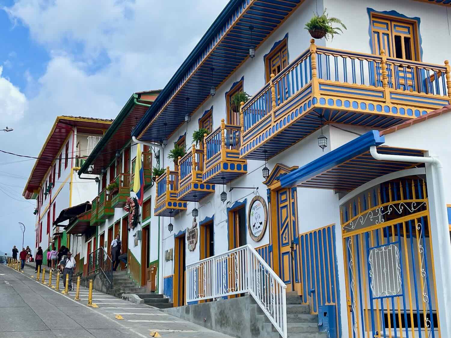
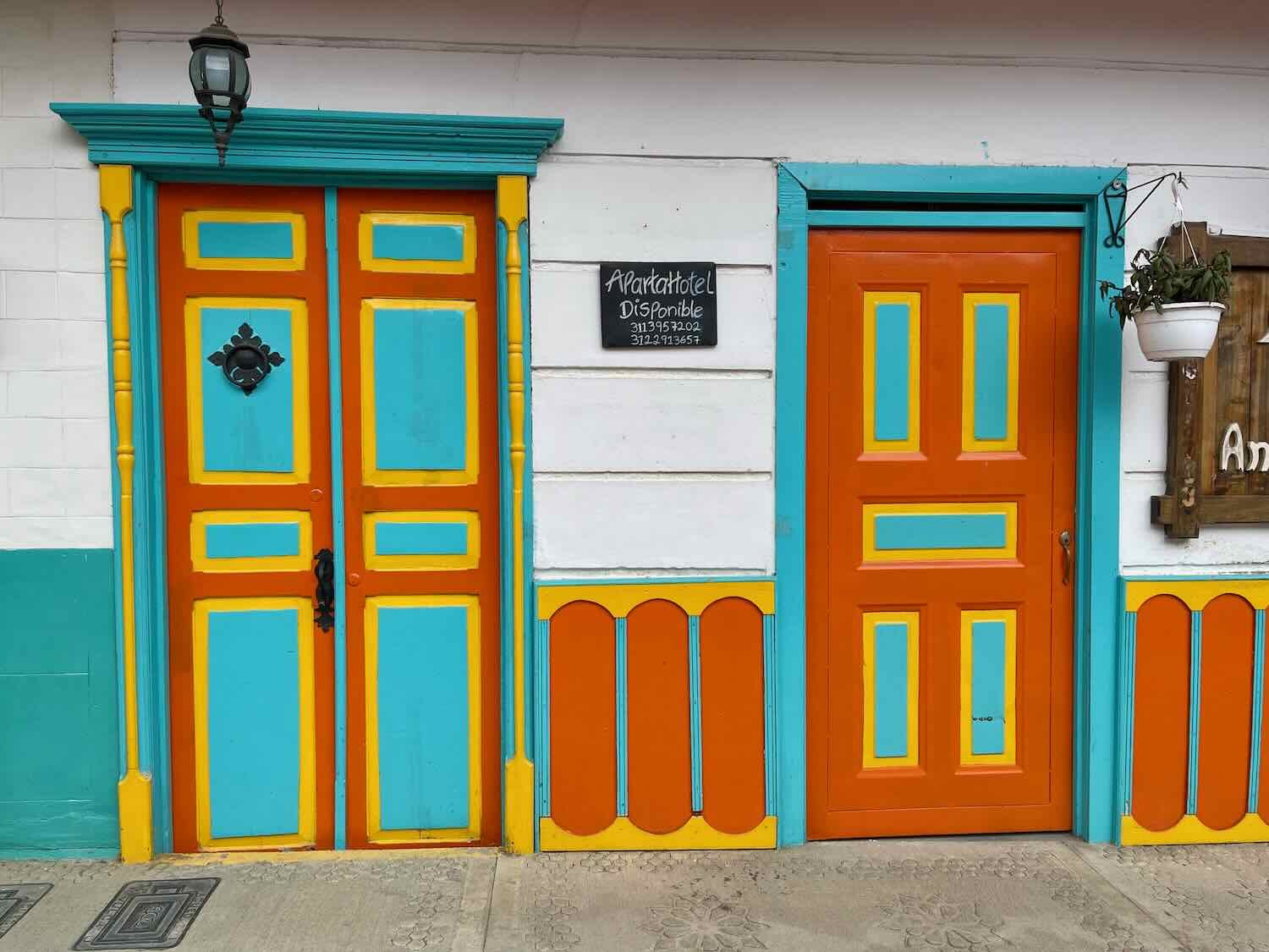
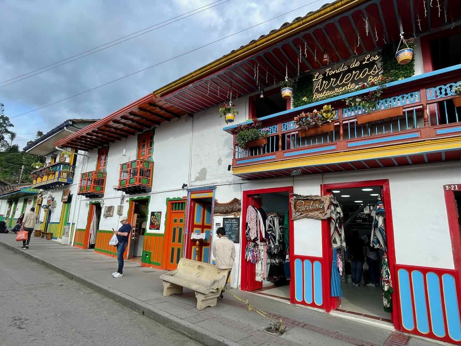
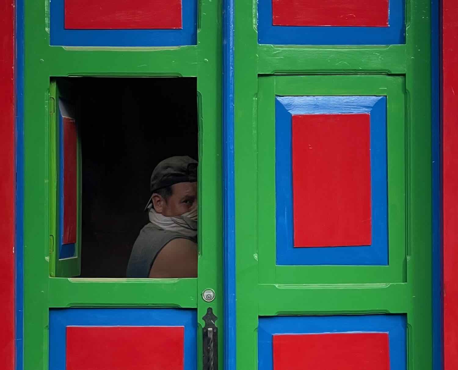
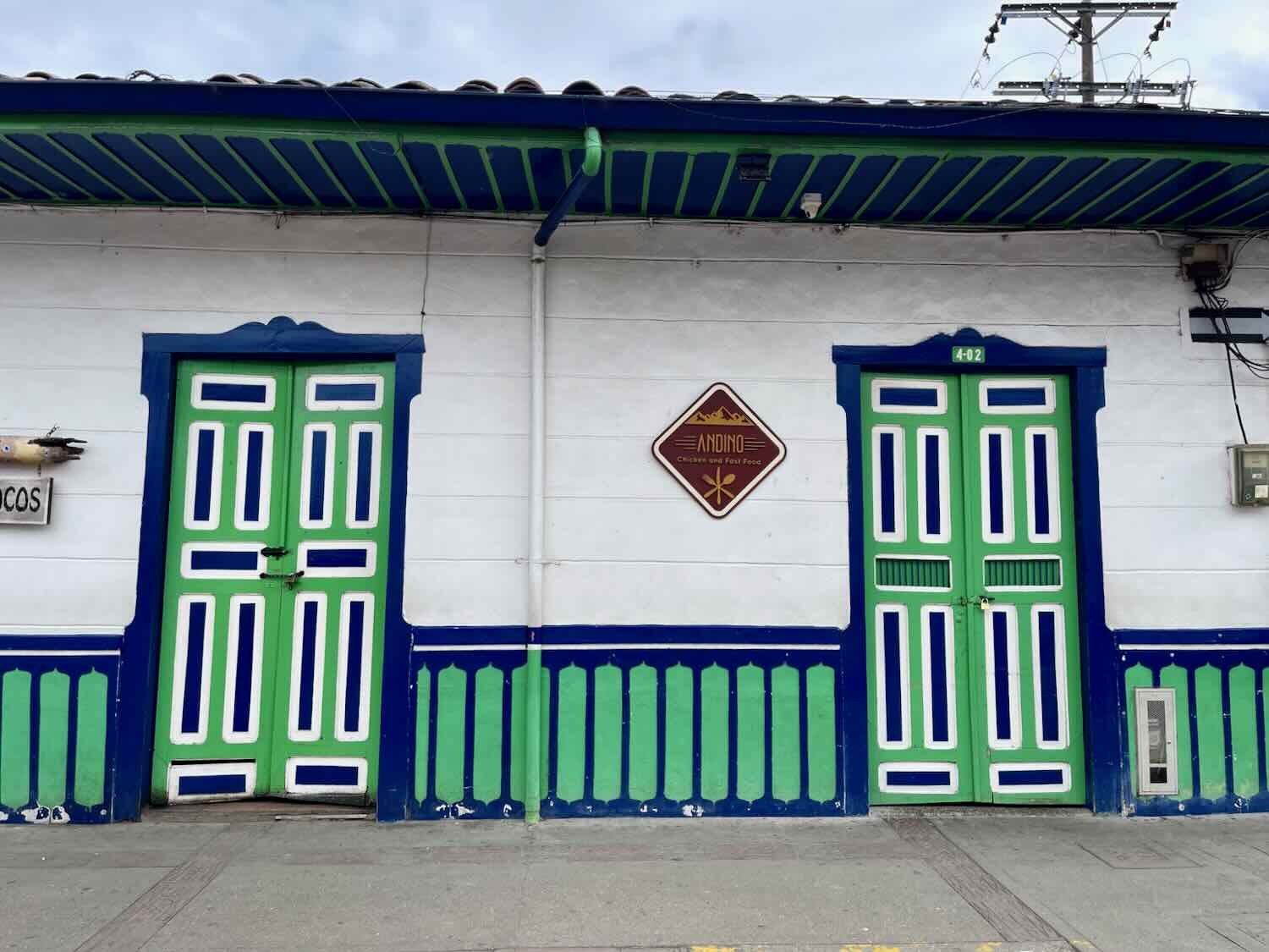
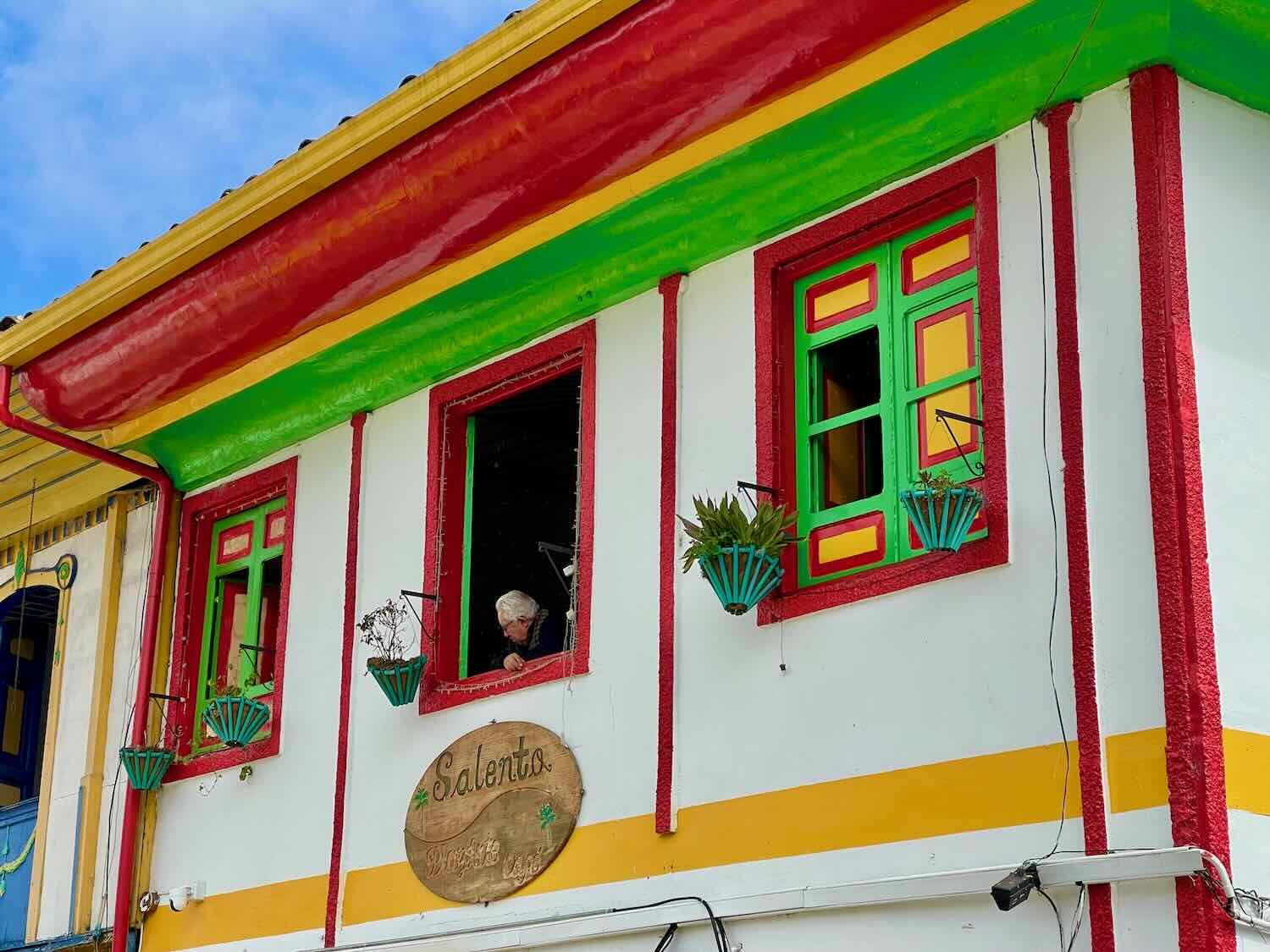
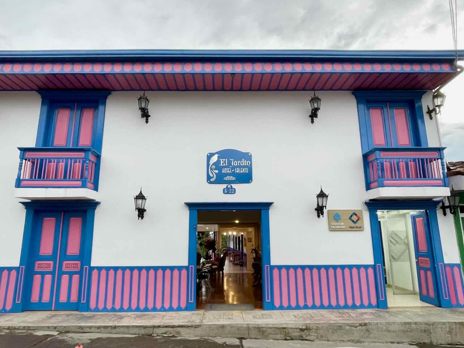
One of the things that Salento is most famous for is its architecture. The main roads and plaza are lined with tightly-packed, two-story buildings that are made of white stucco, with flamboyantly-painted wooden doors, windows, and trim.
The ‘rules’ seem to be that any given building can use only two or three colors of paint, and they should be as bright and contrasting with each other as possible. There are no fancy designs or murals. Instead, the painted elements have a base color, then raised lines and trim are painted in the alternate colors. No two buildings are alike. And when seen all together, the effect is a riot of colors - sometimes enhanced by rows of blooming flowers on balconies. Here is a photographic feast of Salento architecture:
Calle Real is the town’s Main Street, where its signature style of architecture is on full display. Salento, Quindío Department, Colombia. Copyright © 2019-2024 Pedals and Puffins.
There are so many color pallets that it was inevitable we would find one that was a perfect match for PedalingGal’s shirt. Salento, Quindío Department, Colombia. Copyright © 2019-2024 Pedals and Puffins.

The painted houses are so iconic that souvenir stores sell replicas, so you can take one home. Salento, Quindío Department, Colombia. Copyright © 2019-2024 Pedals and Puffins.
As a prominent stop along the Ruta del Café (the coffee route) in Colombia, Salento would be a great place to buy some of the country’s best coffee. With a name like Sublime, this coffee sets a pretty high expectation for flavor. Salento, Quindío Department, Colombia. Copyright © 2019-2024 Pedals and Puffins.
We’re not big coffee drinkers. However, we can personally attest to the fact that you can also get awesome hot chocolate (like this one) in town. Salento, Quindío Department, Colombia. Copyright © 2019-2024 Pedals and Puffins.
Restaurants in Salento take great pride in their food presentation. This tray of arepas with tomato sauce was both enchanting and delicious. Salento, Quindío Department, Colombia. Copyright © 2019-2024 Pedals and Puffins.
They say that the national game of Colombia is Tejo (where a metal puck is thrown at a target). But from what we have seen, billiards might be more popular. Every town has a billiards hall, and they are always full of people. Salento, Quindío Department, Colombia. Copyright © 2019-2024 Pedals and Puffins.
One of the other ‘icons’ of Salento is the Jeep Willy. In the late 1940s (after WWII) the United States Army had a surplus of Jeeps and started exporting Willys to countries like Colombia. At first they were sold to the military. But folks who lived in mountainous regions - like coffee country - immediately embraced these ‘mechanical mules’ for their combination of being very light when empty, yet able to carry surprisingly heavy payloads. It also helped that they were extremely maneuverable on rugged, mountain roads and relatively easy to repair.
Before long, Jeep Willys became an integral part of Colombian mountain culture. To this day Jeeps are ubiquitous on the dirt roads that connect mountain towns - hauling bags of agricultural produce, serving as public transportation, and carrying tourists to their mountain adventures. There are town monuments dedicated to the Jeeps, small replicas of the Jeeps you can buy in stores, and the pristine condition of the old Jeeps on the road all show the deep respect people here have for this icon of the mountains.
In Salento, one side of the central plaza is essentially a ‘taxi stand’ for a fleet of Jeeps that carry passengers between towns and trekking destinations for a low, fixed fee. Each one is outfitted with bench seats that hold 10 people inside, with room for three more to stand on the back bumper (hanging on to the metal roof). Jeeps leave the plaza for their destination as soon as they are full with at least 10 passengers. If you are familiar with the size of Jeeps, getting 10-13 passengers plus a driver into one is a very tight fit. Some of the Jeeps are even original Willy’s from the 1940’s. But many are more modern and “only” date back 30-40 years. There must be some good mechanics around to keep these vehicles running, given the wear and tear they get on the steep mountain roads.
A rainbow of Jeeps waited along one side of the central square to take people to neighboring towns or hiking locations. These Jeeps are the primary, inter-town form of public transportation in the mountains. Salento, Quindío Department, Colombia. Copyright © 2019-2024 Pedals and Puffins.
This old Jeep Willy is dressed up as a photo prop for tourists - evoking the Jeep’s role as a work-horse for hauling anything and everything through the mountains. Salento, Quindío Department, Colombia. Copyright © 2019-2024 Pedals and Puffins.
Just like with the painted houses, you can buy a souvenir Jeep Willy to take home and help you remember your adventures in coffee country. Salento, Quindío Department, Colombia. Copyright © 2019-2024 Pedals and Puffins.
There are a couple of excellent overlooks right on the edge of town, and we walked up to their heights a couple of times during our visit. One of the overlooks faces westward, giving a panoramic view of the town. A short walk along a ridge takes you to the other overlook, which provides a spectacular view across the Quindío River Valley, with the mountains of Los Nevados National Park fading away into the distance.
Climbing the roughly 200 stairs to the Alto de la Cruz, an overlook that provides bird’s eye view of the town. Salento, Quindío Department, Colombia. Copyright © 2019-2024 Pedals and Puffins.
View of Salento from the Alto de la Cruz overlook. Salento, Quindío Department, Colombia. Copyright © 2019-2024 Pedals and Puffins.
This mural near the overlooks says, ‘Our wealth is our water.’ Salento, Quindío Department, Colombia. Copyright © 2019-2024 Pedals and Puffins.
An Andean motmot flies over the valley (with coffee bushes below). Salento, Quindío Department, Colombia. Copyright © 2019-2024 Pedals and Puffins.
The second overlook has a magnificent view across the Quindío River Valley. Salento, Quindío Department, Colombia. Copyright © 2019-2024 Pedals and Puffins.
The imposing mountains of the Los Nevados National Park rise on the far side of the valley. Farms and pastures blanket the valley floor. Salento, Quindío Department, Colombia. Copyright © 2019-2024 Pedals and Puffins.
A forest path led from the overlook down the far side of the mountain. One day we spent several hours exploring the unmarked, interlocking paths that wound through thick, wet woodlands and along the edges of steep pastures inhabited by a few horses. There was hardly anyone else on the trails, which made for a much nicer walk than on the more crowded tourist trails farther up the canyon. We almost made it to the road that winds through the bottom of the valley. But with only about 150 ft (45 m) to go, our trail devolved into a small, muddy stream with steep walls, so we turned around and hiked back up the mountain.
Exploring one of the unmarked trails on the mountainside below the overlook. With all of the recent rain, we did get rather muddy. Salento, Quindío Department, Colombia. Copyright © 2019-2024 Pedals and Puffins.
We were thrilled to see this handsome Andean motmot. At 19 inches in length (48 cm) it’s the largest species of the motmots, and it looked huge. Salento, Quindío Department, Colombia. Copyright © 2019-2024 Pedals and Puffins.
We were lucky to catch sight of this moustached puffbird, sitting quietly on a branch in the forest. Salento, Quindío Department, Colombia. Copyright © 2019-2024 Pedals and Puffins.
There weren’t many flowers in bloom, but this tiger flower was a show-stopper. Salento, Quindío Department, Colombia. Copyright © 2019-2024 Pedals and Puffins.
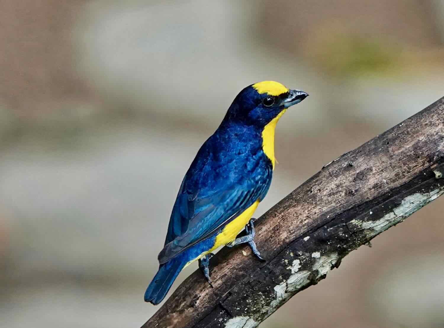
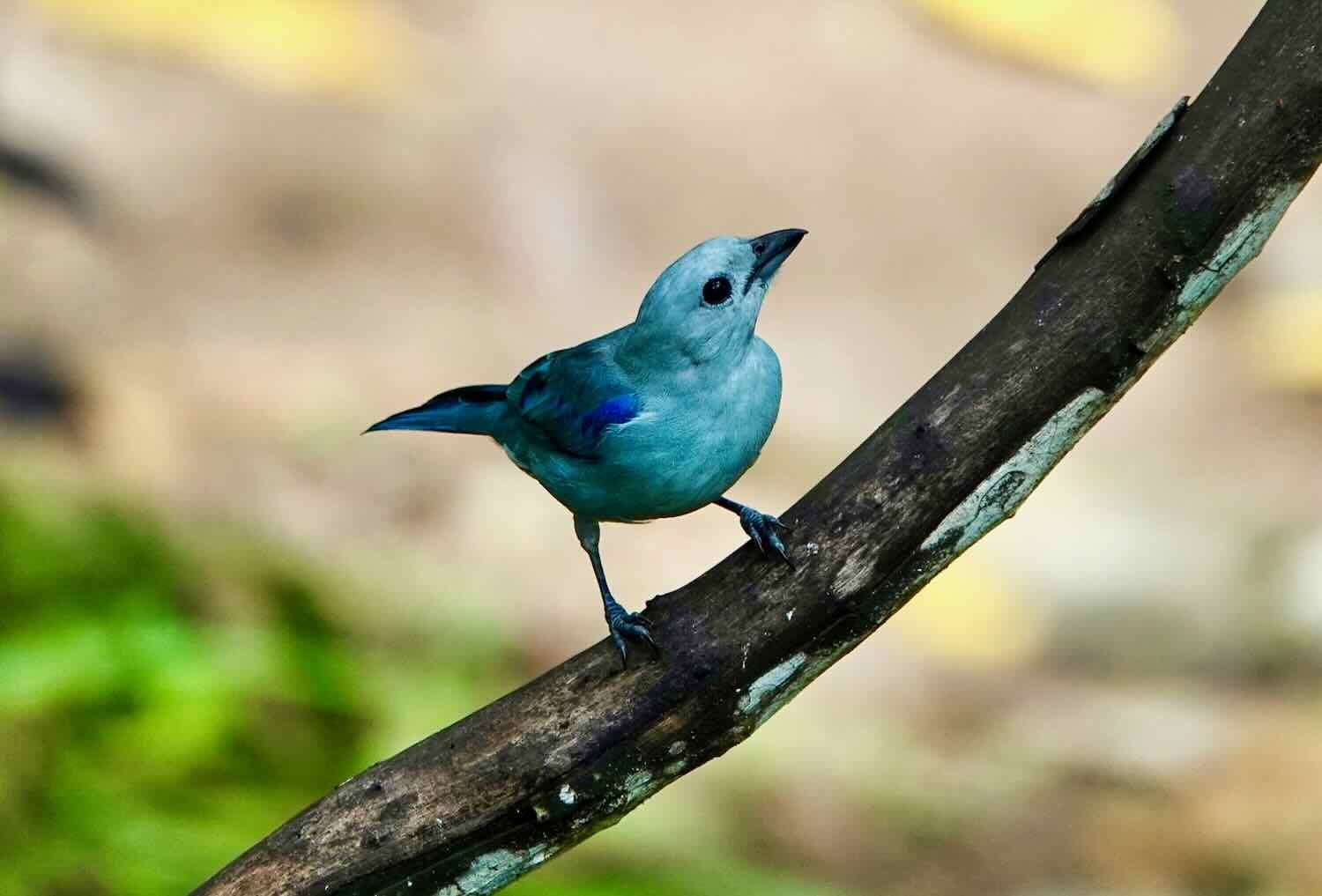
Another spectacular bird was the Inca jay, with its outlandish, blue crest and intense, yellow eyes. Salento, Quindío Department, Colombia. Copyright © 2019-2024 Pedals and Puffins.
For such a brightly-colored bird, Inca jays were surprisingly inconspicuous. Their yellow and green colors blended in with the forest. Salento, Quindío Department, Colombia. Copyright © 2019-2024 Pedals and Puffins.
Cycling Across the Central Andean Ridge
Ordinarily, when faced with long route segments on rural, gravel roads through high steep mountains, we prefer to break the cycling into smaller chunks. This allows us to take our time, enjoy the natural landscapes, and have plenty of time to deal with any difficulties that might arise.
However, our journey across the Central Andean Ridge in Colombia did not allow for that. Until recently there had been a remote hostel that provided food and a bed along the way. But we knew before we departed that it was closed. The other option would be to wild camp. For people unfamiliar with travel in these mountains, that may seem like a good option. But unfortunately there are very few flat places to camp that are more than a few inches from the dirt road. So we knew that the ride over the Andes central mountain ridge on a rough dirt road was likely to be a long and challenging one. We had heard rumors of one, remote restaurant. But with scant information, we decided not to rely on it.
The morning of our departure from Salento we woke up at 5am, and were out the door soon after dawn. That’s when our first problem arose. There were very dark, rain clouds looming in the direction we were going. A quick check of the weather app showed that the chance of rain had increased substantially overnight. It didn’t look good.
At that moment, we actually thought it might be better to postpone for a day. Rain and mud would just make the long and challenging dirt road more difficult at best. At worst, flooding could be an issue. In addition, some rural roads become impassable as the dirt turns into mud that sticks to bicycle tires like peanut butter. We got out our phone to try to make a reservation for another night in our hotel. But we were out of luck. The hotel where we had been staying in Salento was fully booked. So we bit the bullet, and cycled down the road towards the dark clouds, as rain started to fall. It felt ominous.
Surprisingly, the first few miles of cycling out of Salento were actually pretty good. The condition of the dirt road was fine, and there was hardly any traffic. While the uphill gradient was tough, it was certainly rideable. Pretty soon we were feeling good about our prospects, although we were still headed toward that big bank of storm clouds.
After climbing rapidly into the mountains, we were treated with a view of the sunrise over the town of Salento, in the valley behind us. Unfortunately, a bank of dark storm clouds was slowly moving in. Salento-Toche National Road, Quindío Department, Colombia. Copyright © 2019-2024 Pedals and Puffins.
The first few miles of road were in pretty good condition, as we headed into the Central Andes mountain range. Salento-Toche National Road, Quindío Department, Colombia. Copyright © 2019-2024 Pedals and Puffins.
We could see hillsides covered with coffee bushes near remote farmhouses. Many homes were quite far from the main road, and looked virtually inaccessible. Salento-Toche National Road, Quindío Department, Colombia. Copyright © 2019-2024 Pedals and Puffins.
It was astonishing to see where people built homes in these mountains. There was hardly any level ground, so houses were situated on the sides of hills, perched on man-made terraces. Salento-Toche National Road, Quindío Department, Colombia. Copyright © 2019-2024 Pedals and Puffins.
Slowly, however, the road surface began to deteriorate. Several weeks of significant rainfall had taken its toll. Approximately three miles (5 km) into the ride, we passed an unnerving sign stretched across the road. It warned of road construction ahead, and basically said to travel at your own risk. Of course, any seasoned traveler knows that sometimes these signs are overkill, and the road conditions may be perfectly fine. But in this part of the world, where warning signs are very rare, it made us wonder.
This sign over the road did not inspire a lot of confidence. Basically, it says ‘travel at your own risk.’ Salento-Toche National Road, Quindío Department, Colombia. Copyright © 2019-2024 Pedals and Puffins.
Sure enough, just up the road, we encountered a construction crew that appeared to be shoring up a section of the road that had slumped. Water seeping off the steep mountain slope, combined with rain had turned the road into a muddy mess. Our progress slowed accordingly. Cycling though deep mud can be tricky. You need enough momentum to not get bogged down, while at the same time not going so fast that you lose control and end up with a messy, wet landing.
Construction work not far out of Salento had turned our road into a fiesta of slippery, rutted mud. The road actually got much worse than the photo but we were too busy trying to keep the bikes vertical to take a picture of those sections. Salento-Toche National Road, Quindío Department, Colombia. Copyright © 2019-2024 Pedals and Puffins.
Much of the lower slopes of the mountain had been cleared for pastures, with long views across open fields. Salento-Toche National Road, Quindío Department, Colombia. Copyright © 2019-2024 Pedals and Puffins.
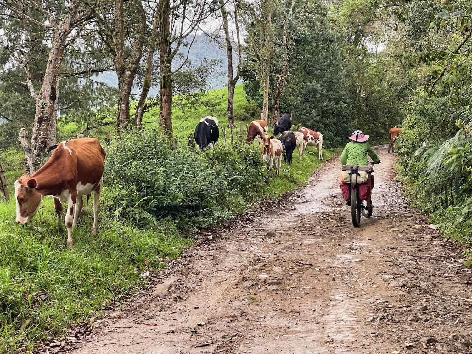
In spite of the fact that the road was lined with barbed wire fences, we encountered plenty of cows grazing right along the road. The cows must have thought the grass looked greener on the other side. Salento-Toche National Road, Quindío Department, Colombia. Copyright © 2019-2024 Pedals and Puffins.
After we had gained a couple of thousand feet in elevation, we were enveloped by the clouds. We stopped for a quick break near a farm with the cheerful name of Finca Alegrias (a.k.a., ‘joyful farm’). Salento-Toche National Road, Quindío Department, Colombia. Copyright © 2019-2024 Pedals and Puffins.
A couple of bananas brought up from town gave us the energy to keep climbing. Salento-Toche National Road, Quindío Department, Colombia. Copyright © 2019-2024 Pedals and Puffins.
These big flower clusters (6 inches across) grew thick a couple of places along the road. Bomarea patinii is another plant that has no common name. Salento-Toche National Road, Quindío Department, Colombia. Copyright © 2019-2024 Pedals and Puffins.
As the mist settled in the forest, rain dripped off of the trees. Salento-Toche National Road, Quindío Department, Colombia. Copyright © 2019-2024 Pedals and Puffins.
Although there were gates across the side roads, this one said it was okay for cyclists, hikers and people on horseback to enter. Salento-Toche National Road, Quindío Department, Colombia. Copyright © 2019-2024 Pedals and Puffins.
Eventually we broke through the clouds, and started to see some blue sky, again. Salento-Toche National Road, Quindío Department, Colombia. Copyright © 2019-2024 Pedals and Puffins.
Some Andean cows are hybrids that have Scottish Highland genes. This guy looked like he had some highland ancestors. Salento-Toche National Road, Quindío Department, Colombia. Copyright © 2019-2024 Pedals and Puffins.
As the road became steeper and more slippery, we felt worn out from the long, relentless climb. We started to engage in some wishful thinking that the hostel that had reportedly closed operation, which was located just before the top of the ridge, might actually be open. When we were overtaken by a couple of local cyclists who stopped to chat, we asked if they knew whether the hostel was still taking guests. Diego, who spoke some English, said he thought it was open, and that gave us some hope as we pushed onward.
When we were just a couple of hundred yards from the hostel, we saw Diego and his friend heading back down the hill. They had stopped to talk with someone at the hostel, who said we might be able to get a room, “if we asked the owner.” That sounded very promising, and we really started to think that this could be just what we needed.
But when we finally arrived, it was clear the situation was not nearly as rosy as we had hoped. The guy who spoke with Diego was a ranch hand who was busy unloading milk from big canisters carried by a horse, onto a truck that would haul it down the road to town. When we inquired about the hostel, what he really said was that he didn’t know if the hostel was open, and that we would have to ask the owner. That was a lot less reassuring.
A ranch hand at the Eagle’s Nest farm had brought canisters of fresh milk down to the road on horseback, to load onto a truck that was heading for Salento. Salento-Toche National Road, Quindío Department, Colombia. Copyright © 2019-2024 Pedals and Puffins.
Furthermore, the hostel itself was perched a couple of hundred feet higher than the road, on top of a cliff. It was now obvious to us why the hostel was known as The Eagle’s Nest. To get there, we would have had to trudge up a very muddy, absurdly steep pathway - with a low probability that there would actually be accommodations at the top. Getting the loaded bikes up that hill seemed like an almost impossible task.
PedalingGal briefly considered hiking up while PedalingGuy stayed below with the bikes, just to check on availability. But given that the hike up would take a whole lot of energy, and the answer to a request for lodging would most likely be ‘no,’ we decided to keep going.
Before heading out, we gave ourselves a very special treat. PedalingGuy had been carrying two, precious Clif Bars - a type of energy bar popular in North America - since our stay in Guatemala City. They’re probably our favorite, go-to road food because they’re packed full of energy, and actually taste pretty good. A Clif Bar was just the thing to help fuel our ride to the top of the ridge.
The final three miles (5 km) to the top of the ridge - known as the Alto de La Línea - were surprisingly difficult. The slope had gotten steeper, the road was rockier and muddier, and we were very tired. With frequent stops and a fair amount of hike-a-bike, we finally made it to the top of the ridge at 11,083 ft in elevation (3,378 m). It was an awesome feeling to reach the summit.
The final couple of miles to the top of the Alto de La Línea were pretty steep. Salento-Toche National Road, Quindío Department, Colombia. Copyright © 2019-2024 Pedals and Puffins.
The trees near the top of the pass looked like they led a tough life. Salento-Toche National Road, Quindío Department, Colombia. Copyright © 2019-2024 Pedals and Puffins.
In the final mile, we entered a true cloud forest, with thick tangles of vegetation and a very muddy road. Every limb on the trees seemed to be covered with air plants, soaking up water from the ever-present clouds. Salento-Toche National Road, Quindío Department, Colombia. Copyright © 2019-2024 Pedals and Puffins.
It was a fantastic feeling to reach the summit of the Alto de La Línea. According to the sign, we reached an altitude of 11,083 ft (3,378 m). Salento-Toche National Road, Colombia. Copyright © 2019-2024 Pedals and Puffins.
By that time we had been cycling uphill for seven hours, and we were sooooo ready for a downhill.
The descent from Alto de La Línea was the most enjoyable part of the day. The road was rocky, but not too bad. The weather had cleared, giving us spectacular views of the valley below. And pretty soon we saw the most fascinating and unique feature of the ride - the world’s largest forests of Colombia’s rare national tree, the Quindío wax palm.
The big patch of forest on the hillside in the distance is made up almost entirely of endangered Quindío wax palms, Colombia’s national tree. Salento-Toche National Road, Tolima Department, Colombia. Copyright © 2019-2024 Pedals and Puffins.
Up close, we could see the Quindío wax palms growing in dense stands. Salento-Toche National Road, Tolima Department, Colombia. Copyright © 2019-2024 Pedals and Puffins.
The Quindío palm is such an important national symbol in Colombia that its image is used on the 100K peso currency note (about US$25). Colombia. Copyright © 2019-2024 Pedals and Puffins.
Over many years, cows etched terraced paths in the steep-sloped pastures that surrounded the palm forests. Salento-Toche National Road, Tolima Department, Colombia. Copyright © 2019-2024 Pedals and Puffins.
Exposed slopes tended to be covered with grasslands, while the palm forests grew in more sheltered drainages. (Note the ranch house perched on the remote, far side of the valley.) Salento-Toche National Road, Tolima Department, Colombia. Copyright © 2019-2024 Pedals and Puffins.
The palm forests were really fascinating to see. Typically palms are associated with costal lowlands and beaches rather than mountains. There are very few species of palms that grow at high elevations like this. In fact, these palms were so high in the Andes that they were often in the clouds. But that’s not all. Quindío wax palms also hold the record for being the world’s tallest palms. They can live for 100 years and reach nearly 200 ft in height (60 m). If you’ve read about our travels through the redwood forests of California, you know we love the tall trees.
Cycling past a particularly tall Quindío wax palm. It’s the tallest species of palm in the world, reaching heights of 200 ft (60 m). Salento-Toche National Road, Tolima Department, Colombia. Copyright © 2019-2024 Pedals and Puffins.
For an hour and a half we bounced down the steep, eastern side of the ridge. At the bottom we entered a narrow ravine, occupied by a small, family-run restaurant. This was another place where we had hoped, maybe, we could spend the night. Back in the fall of 2023, another cyclist posted online that he had slept on their porch while passing through. But to us, it didn’t look like a great place to stay. There were at least a dozen people hanging around, plus lots of animals (dogs, horses, chickens, pigs, etc.) wandering freely. It seemed unlikely we would get much sleep there.
However, it was late afternoon and we were ready for a much-needed break. We parked our bikes, grabbed a couple snacks, and relaxed for a couple minutes on the restaurant’s benches. But we still had 10 miles (16 km) to go to reach the town of Toche, with more mountains in between. We couldn’t delay for long, since darkness was rapidly approaching.
We crossed our fingers, hoping that we could make better time on the final leg of the ride. For one thing, there would be a lot more downhills than uphills. But luck was not with us. As we were leaving the restaurant, we realized that the sky had darkened considerably in the direction we would travel. And within a few minutes, it began to rain pretty hard - as in torrential downpour.
We stopped and took shelter under the overhang of an old farm building but it only partially sheltered us from the rain. While we were waiting, a girl riding bareback on a horse came barreling downhill on the steep road in the heavy rain, jumped off her horse and joined us in what little shelter we had. Her horse, unfazed by the rain, munched happily on the grass nearby as we waited for the storm to pass.
When the rain died down to a drizzle, we hit the road again. But now the surface was a seriously muddy mess. Some of the puddles were quite deep. PedalingGuy attempted too ride through one that turned out to be over a foot deep - with water up over his wheel hubs. The water was a dark brown, so we never knew how deep the puddles really were until we were in them. Luckily, PedalingGuy made it to the other side without falling into the murky water, but his bike and legs ended up with a coating of mud
After a heavy rain, the road became even more muddy, slowing down our progress. Salento-Toche National Road, Tolima Department, Colombia. Copyright © 2019-2024 Pedals and Puffins.
Cows weren’t the only domestic animals in the remote farms. We passed this pig, out for a stroll along the road. Of course, she didn’t mind the mud. Salento-Toche National Road, Tolima Department, Colombia. Copyright © 2019-2024 Pedals and Puffins.
At first we tried to work our way around the puddles, but it soon proved fruitless since most of them completely crossed the road. Our bikes, shoes and legs became caked with mud. The effort of dismounting from the bikes to negotiate around the wet spots - trying not to slip and fall - slowed us down a lot and drained our energy even more. The thing that kept our spirits up was that the valley continued to offer up incredible scenery. The Quindío wax palms, in particular, looked beautiful in the mist and clouds.
A heavy mist hung in the air between intermittent rain showers, highlighting the graceful shapes of the Quindío wax palms. Salento-Toche National Road, Tolima Department, Colombia. Copyright © 2019-2024 Pedals and Puffins.
Quindío wax palms in the fading light. Salento-Toche National Road, Tolima Department, Colombia. Copyright © 2019-2024 Pedals and Puffins.
Clouds surrounded the Quindío wax palms. Salento-Toche National Road, Tolima Department, Colombia. Copyright © 2019-2024 Pedals and Puffins.
Around 6:30pm we reached a grassy pull-out next to the road. The sun had disappeared behind the mountains, and pretty soon darkness would envelop us. We still had about five miles (8 km) of cycling to go before reaching the town of Toche. It was time to decide if we would set up a wild camp, or continue cycling down the steep, rocky, wet, muddy road in the dark.
Neither option was particularly good. The only spots to camp were only a couple feet from the edge of the road and were so filthy we would likely get our sleeping gear all muddy. Plus, there was a good chance it would rain even more during the night. On the other hand, the road was in terrible condition and rather treacherous for cycling in the dark.
After talking it over, we agreed that we would both prefer to make it to town where we could get cleaned up and sleep with a roof over our heads. We knew it would be a little dangerous, so we made a pact that we would go as slowly as necessary to ride safely. With night falling, we got out our headlights, attached them to our bikes and pushed on.
The descent into Toche was a hair-raising adventure. Instead of improving as we got close to town, the road became even more slippery, rocky and steep. The downhill was strewn with ruts, tight turns and cliffs. Our bike headlights illuminated the path just ahead, but they weren’t much use as we curved back and forth down sharp hairpin turns. As cyclists know, your bike light continues to shine forward when you need to see around the corner of a sharp turn. Half the time it was an act of pure faith to keep cycling when we couldn’t see the road ahead around a curve. Several times PedalingGal gave up in fear, and pushed her bike down the sketchier sections. Somehow, PedalingGuy managed to cycle all the way down.
In the darkness of the descent, this tropical ground snake (Atractus titanicus, no common name) slithered across the road in front of us. You can see its shadow from our bike headlights. Salento-Toche National Road, Tolima Department, Colombia. Copyright © 2019-2024 Pedals and Puffins.
We finally reached the small, mountain village of Toche after 14 hours of almost constant travel, totally exhausted.
But we couldn’t stop to rest. The businesses in small, mountain villages don’t stay open late, and we were already pushing our luck by arriving after 8pm. When we couldn’t immediately locate a hotel or hostel, we asked a lady in a small tienda about lodging options in town. It turned out that there was a hostel right next door. But it was pretty rundown, and we would have had to take a room with a shared bathroom and cold water. We were ready for a bit more pampering than that, so we asked her if there were any other hotels that would, at least, have a private bathroom.
She thought about it for a moment, then said there might be another option. With that, we followed her all the way to the far side of town. The lady had to bang on the metal door to rouse the owner, but once we were inside it was clear we had found the perfect place. Not only could we have a private bathroom, but for a total of US$20, we could even have hot water. It was heaven.
The one restaurant in town that served dinner was closed, so we bought a simple meal of bread, tuna and cheese from the lady’s little store. After dinner, we barely found the strength to shower - which took an extra long time as we scrubbed off all of the mud encrusted on our legs. By then it was 11pm, and we went straight to bed.
During the night, we could hear lots of rain pounding down upon the aluminum roof. From the comfort of our warm, dry rooms, we basked in the thought of not having toughed it out by camping on the cold rainy mountainside. Simple things like staying warm and dry can sometimes provide so much pleasure.
In the end we had cycled more than 30 miles (48 km), with more than 5,000 ft (1,525 m) of climbing on a rough dirt road with lots of challenging weather, to make it across a significant portion of Columbian Central Andes mountains. It was definitely an adventure.
Hanging out in Toche
We were not particularly interested in cycling out the next morning. We therefore spent a nice, relaxing rest day in the village of Toche (pop. 91). The town only had two, short streets perpendicular to each other. So we took our time walking through the town, enjoying all the little details of mountain village life.
First thing in the morning we saw this Vietnamese potbellied pig guarding a patio next to our hotel. But by the time we returned the pig was gone, and we didn’t see it again. Toche, Tolima Department, Colombia. Copyright © 2019-2024 Pedals and Puffins.
Across the street from our hotel was where the town’s main restaurant was located. Throughout the day, folks would gather there for a snack, a coffee and a chat with neighbors. It was also a big gathering place for the town’s dogs. At any given time there would be 2-5 dogs staring at you while you ate. Occasionally the restaurant owners would chase away the dogs, only for them to return about 30 seconds later. Toche, Tolima Department, Colombia. Copyright © 2019-2024 Pedals and Puffins.
The bell tower of the brick and stone church at the center of town was still under construction. That didn’t stop them from loudly ringing the two bells that were already installed for what seemed like an eternity. It was Sunday, after all. Toche, Tolima Department, Colombia. Copyright © 2019-2024 Pedals and Puffins.
Each entrance to town was covered by a fancy portal. When we had cycled into the village the previous evening, we were welcomed by flashing, colored lights under the roof. Toche, Tolima Department, Colombia. Copyright © 2019-2024 Pedals and Puffins.
We walked down to the Coello River, at the edge of town. It was rushing fast, but not too high on its banks - even after all the rain. Toche, Tolima Department, Colombia. Copyright © 2019-2024 Pedals and Puffins.
A foot bridge led across the river, to a cluster of houses on the other side. Without road access, the people who lived there relied on horses to carry supplies to their homes. Toche, Tolima Department, Colombia. Copyright © 2019-2024 Pedals and Puffins.
It was pretty common to see someone riding through town on a horse, or a group of horses like this one, just wandering around, unattended. Toche, Tolima Department, Colombia. Copyright © 2019-2024 Pedals and Puffins.
This horse had been ‘parked’ under the canopy at one of the entrances to town, while its owner went to take care of some business. Toche, Tolima Department, Colombia. Copyright © 2019-2024 Pedals and Puffins.
That afternoon we had more heavy rain. It came down for several hours. That didn’t bode well for our ride out the next day. Around 6pm the restaurant in town where we’d had a nice lunch was already closed. We ended up buying some drinks at a tienda, and a bag full of enpañadas from a lady selling them from a table set up outside.
Back Down to the Pavement
Following a now familiar pattern, we were up at 5am the next day. But just as we were getting ready to depart, it started to rain. Hard. Again. We aborted our departure and went back to bed. It rained pretty steadily for the next several hours. Whenever the rain grew light, the local roosters would start crowing. Then, when the rain picked up again, that shut them up.
Finally, after 8am, the rain ended and the sun even came out. It was time to go.
Happily, our worst fears about the road being full of ruts and mud were not realized. Sure, there were a few sloppy sections and puddles. But there was much less mud than we expected - and a whole lot less than what we had encountered on the ride between Salento and Toche.
Toche is in a valley, so of course we had to climb another ridge to exit town. There were gorgeous vistas all morning, as we cycled past farms growing beans, potatoes and coffee. We continued to be amazed by how people were able to make a living in such remote areas, farming on incredibly steep mountainsides. Unfortunately, we didn’t get any good looks at the nearby Machín Volcano - which was hidden among the low-hanging clouds.
Cycling out of the valley where we had taken a rest day. Toche-Cajamarca Road, Tolima Department, Colombia. Copyright © 2019-2024 Pedals and Puffins.
The Coello River cut a narrow path far below us, through the bottom of the canyon where we had started cycling in the morning. Toche-Cajamarca Road, Tolima Department, Colombia. Copyright © 2019-2024 Pedals and Puffins.
On the way up the ridge, we passed a couple of playful mules hanging out by the side of the road. Toche-Cajamarca Road, Tolima Department, Colombia. Copyright © 2019-2024 Pedals and Puffins.
Once we had passed them, the mules began to follow us. If we stopped, they stopped. If we moved, they followed. It reminded us of the time a little donkey followed us in Baja. Toche-Cajamarca Road, Tolima Department, Colombia. Copyright © 2019-2024 Pedals and Puffins.
Near the top of the ridge, we stopped to admire this lovely gray horse. Toche-Cajamarca Road, Tolima Department, Colombia. Copyright © 2019-2024 Pedals and Puffins.
After cresting the summit, we sailed down the far side of the ridge. It was quite steep, but so much easier to ride in daylight than at night.
Enjoying an easy descent out of the Central Andes Mountains. Toche-Cajamarca Road, Tolima Department, Colombia. Copyright © 2019-2024 Pedals and Puffins.
These guys were unloading huge sacks of potatoes from their horses, and into a truck - presumably to take the produce down the mountain and to market. Toche-Cajamarca Road, Tolima Department, Colombia. Copyright © 2019-2024 Pedals and Puffins.
Large areas of very steep mountainsides were planted in beans (shown here) and coffee. Most of the agriculture was on steep slopes like these. Toche-Cajamarca Road, Tolima Department, Colombia. Copyright © 2019-2024 Pedals and Puffins.
Before long we could see the town of Cajamarca - our destination - in the valley below. Toche-Cajamarca Road, Tolima Department, Colombia. Copyright © 2019-2024 Pedals and Puffins.
It had been weighing on our minds how filthy our bikes had become. They were crusted with mud from the ride between Salento and Toche. Hotel owners sometimes give a long look at the bikes if they are really dirty. Then we have to have a delicate conversation about how we really don’t want to keep them outside because of the risk of theft. It is easier to just clean them off once in a while to avoid as many of those discussions as possible. When we started crossing a number of small, clear streams on the way down the mountain, we had an idea. We decided to wash our bikes in one of the streams along the route.
About four miles (6.5 km) before reaching our destination for the day, we stopped at one of the stream crossings, took out some rags that we carried for cleaning our chains, and gave our bikes a good bath. It took an hour to finally get the bikes reasonably clean, but it was worth it. The bikes looked a lot better, and we didn’t have to worry nearly as much about getting the icky dirt on other things. Leaving a trail of dirt as you cross a hotel lobby is aways a bit embarrassing and doesn’t bode well for our cycling ambassadorships. We were happy.
PedalingGal posing with our newly-cleaned bikes. We washed off a thick layer of encrusted mud in the clear stream that crossed the road. Toche-Cajamarca Road, Tolima Department, Colombia. Copyright © 2019-2024 Pedals and Puffins.
Ironically, just a bit farther down the road, we passed a small truck stopped by another stream. Two guys were busily washing the muck off of their truck in that stream. We waved as we cycled by.
In less than an hour we completed the descent to Route 40, the major highway connector between Bogotá, the largest city in Columbia, and the two big cities on the western side of the mountains, Medellín and Calí.
As we neared the foot of the mountain, we passed this homemade sign pointing in the direction of the town we had stayed in the previous night (Toche) and the town we were going to stay in next (Cajamarca). Toche-Cajamarca Road, Tolima Department, Colombia. Copyright © 2019-2024 Pedals and Puffins.
When we arrived at the paved road, the change was sudden and dramatic. We emerged from the quiet, traffic-free mountains onto a very busy, high-speed road. Fortunately, it was an easy, 1.5 mile (2.5 km) bike ride into the heart of town. We followed along behind a group of pack horses that was also traveling down the highway, led by a guy on a motorbike.
A man led his horses into town along the busy, main highway. We fell in line behind the horses, using them as a bit of buffer from the traffic. Cajamarca, Tolima Department, Colombia. Copyright © 2019-2024 Pedals and Puffins.
Cajamarca (pop. 9,500) is a crowded, bustling town. The major highway runs right through the center, and is lined with businesses that cater to people needing agricultural supplies, people bringing their products to market, as well as travelers like us. In one area there was a row of little empañada shops. Each one had a lady out in front, standing along the side of the highway, gesturing with her hands to encourage travelers to stop and buy a few of the meat-filled pastries for the road. Of all the countries in Latin America we had traveled through so far, Columbia seemed to be the most enthusiastic about empanadas. They were much more common in Columbia than elsewhere.
The central plaza was filled with dozens of kids climbing on the equipment at a playground, as well as playing frisbee or soccer in the open area. Adults snacked on food they bought from the numerous street vendors. Everyone seemed to be having a good time.
The towers of St. Michael the Archangel Church stood at one end of the busy main plaza. Cajamarca, Tolima Department, Colombia. Copyright © 2019-2024 Pedals and Puffins.
There were several statues in the central plaza, but this one caught our eye. It was an homage to the Jeeps that have hauled stuff through Colombia’s mountains since the 1940s. Cajamarca, Tolima Department, Colombia. Copyright © 2019-2024 Pedals and Puffins.
The next day’s departure from Cajamarca was pretty hectic, because we rode on the big highway and there was very little shoulder. There were quite a lot of uphills considering we were supposedly “descending” out of the mountains. The hills were surprisingly steep as well, sending us down into first or second gear as we crawled to the top of each one.
When we reached a toll plaza after about 1.5 hours of cycling, we were ready for a break. We pulled into a large, dirt parking area just before the toll plaza to take a few minutes to recharge. While there, we noticed a raptor perched on a utility pole nearby. It turned out to be a bat falcon, which was really cool. Yes, in case you were wondering, bat falcons do catch and eat bats. They will often wait at the entrance of a cave and catch bats in the air as they exit the cave in the evening.
We spotted a bat falcon perched on a utility pole, along the side of a big highway. Coello-Cocora Toll Plaza, Tolima Department, Colombia. Copyright © 2019-2024 Pedals and Puffins.
Fortunately, as soon as we passed through the toll booth the road became much more modern. This section of the highway had a very wide shoulder, which we really appreciated. It also had a nice, easy gradient for climbing over the next big ridge. We rolled along through a broad valley with banana trees on a hillside, feeling much more relaxed.
On the approach to Ibagué, there were banana trees off in the distance. West of Ibagué, Tolima Department, Colombia. Copyright © 2019-2024 Pedals and Puffins.
The Music Capital of Colombia
We ended up spending much longer than anticipated in the regional capital of Ibagué (pop. 500,000) because, as we were getting ready to leave town, we realized that Columbia’s biggest folk festival would be held there over the coming weeks. That’s right - it seemed like we had stumbled upon another festival. Over the months we have spent in Latin America we have managed to take in a surprising number of festivals. It didn’t take us long to decide to extend our stay. (Another factor was that, on the final weekend, towns throughout the region were celebrating the Festival of San Pedro, and all hotels were full well in advance. We were lucky to secure a room, even in a city the size of Ibagué.)
In addition to hosting the Colombian National Folk Festival, Ibagué is home to the Conservatory of Tolima, Colombia’s most prestigious music school. So it’s no surprise that the city’s nickname is ‘The Music Capital of Colombia.’
Ibagué is known as the Music Capital of Colombia. All around town the name of the city is displayed with a G-clef musical symbol instead of a regular letter ‘g’. Ibagué, Tolima Department, Colombia. Copyright © 2019-2024 Pedals and Puffins.
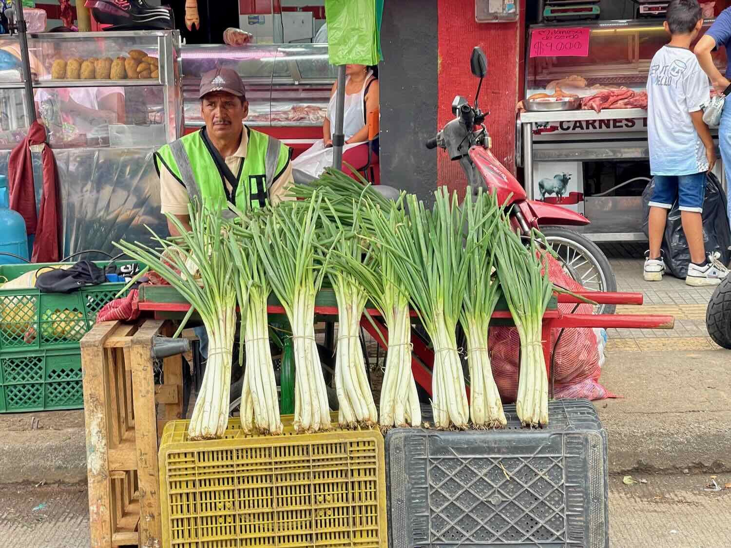
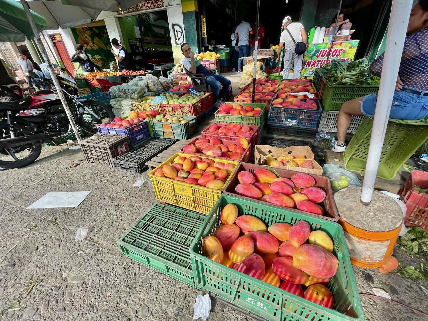
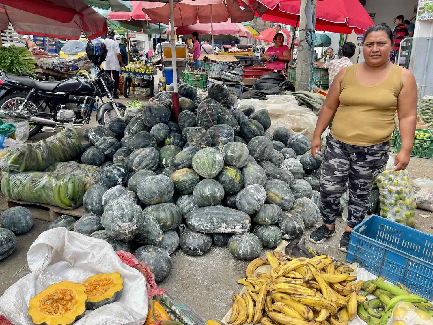
With our long stay, we had plenty of time to get to know the city. We took lots of long walks along the city streets, particularly in the historic center. The municipal market was one of the best we had visited since leaving Mexico - covering many city blocks, with vendors selling piles of wonderfully fresh produce, and anything else you might want to buy.
A family of eared doves had a nest in a potted plant on our balcony. We were in town long enough to watch these two fledgelings grow up and leave the nest. Ibagué, Tolima Department, Colombia. Copyright © 2019-2024 Pedals and Puffins.
The Immaculate Conception Cathedral, near the city’s central plaza. Ibagué, Tolima Department, Colombia. Copyright © 2019-2024 Pedals and Puffins.
Beautiful stained glass in the Immaculate Conception Cathedral. Ibagué, Tolima Department, Colombia. Copyright © 2019-2024 Pedals and Puffins.
There were many vendors along Third Street, a five-block pedestrian way that runs through the heart of the old town. This artist was painting monochromatic scenes in real time. Ibagué, Tolima Department, Colombia. Copyright © 2019-2024 Pedals and Puffins.
This well-polished, vintage, Elektra espresso machine was set up in a street vendors’ stall along Third Street (the downtown pedestrian street). Ibagué, Tolima Department, Colombia. Copyright © 2019-2024 Pedals and Puffins.
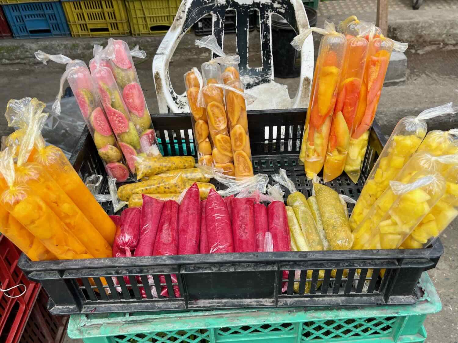
Cholados are a dessert made of fresh fruit, shaved ice and dulce de leche, topped with ice cream, shaved cheese, and/or gummy candies (and sometimes sprinkled with chili powder). Originally from southwestern Colombia, they are very popular in Ibagué. There was a cholado stand every few blocks in our part of town. We had plenty of time to sample a variety of flavors and combinations of ingredients. (It was PedalingGuy’s goal to sample every flavor at least once.) Ibagué, Tolima Department, Colombia. Copyright © 2019-2024 Pedals and Puffins.
We had been surprised how hard it was to find fresh bananas in places like Medellín and other mountain towns. Not so in Ibagué. With plantations in the nearby valleys, bananas were in plentiful supply. Ibagué, Tolima Department, Colombia. Copyright © 2019-2024 Pedals and Puffins.
The people in this region of Colombia love their tamales (in fact, one of the festival days was designated as Tolima Tamal Day). Here, they are wrapped in banana leaves rather than corn husks. This vendor ensured there were enough banana leaves for the city’s many tamal shops. Ibagué, Tolima Department, Colombia. Copyright © 2019-2024 Pedals and Puffins.

On one rainy Sunday morning we participated in the city’s ciclovía (roads closed for use by cyclists, runners and pedestrians). We’ve now joined the ciclovía in five different cities throughout Latin America. Ibagué, Tolima Department, Colombia. Copyright © 2019-2024 Pedals and Puffins.
Nature Near the City
We enjoyed several trips to the city’s renowned San Jorge Botanic Garden, which covers 150 acres (60 ha) of dense forest in the mountains on the edge of town. There are a few acres of plantings but for the most part the “botanic garden” consists of wonderful hiking trails in dense tropical forest, on a mountainside with several overlooks.
Along the way to the city’s botanic garden, we passed the Conservatory of Ibagué, one of two prestigious music schools in the city. Ibagué, Tolima Department, Colombia. Copyright © 2019-2024 Pedals and Puffins.
Entrance to the lovely San Jorge Botanic Garden. Ibagué, Tolima Department, Colombia. Copyright © 2019-2024 Pedals and Puffins.
The cultivated gardens at the San Jorge Botanic Garden actually cover a relatively small area. But they are full of interesting and exotic plants, like this beehive ginger. Ibagué, Tolima Department, Colombia. Copyright © 2019-2024 Pedals and Puffins.
Most of the San Jorge Botanic Garden’s property consists of paths through natural forests, which makes it an excellent place for a hike. Ibagué, Tolima Department, Colombia. Copyright © 2019-2024 Pedals and Puffins.
The forest paths led to several mountain overlooks, with sweeping views of the city below. San Jorge Botanic Garden, Ibagué, Tolima Department, Colombia. Copyright © 2019-2024 Pedals and Puffins.
Right near the entrance, we spotted this chestnut-capped warbler. Ibagué, Tolima Department, Colombia. San Jorge Botanic Garden, Ibagué, Tolima Department, Colombia. Copyright © 2019-2024 Pedals and Puffins.
We saw these stunning bay-headed tanagers. San Jorge Botanic Garden, Ibagué, Tolima Department, Colombia. Copyright © 2019-2024 Pedals and Puffins.
Another beautiful bird, the crimson-backed tanager. San Jorge Botanic Garden, Ibagué, Tolima Department, Colombia. Copyright © 2019-2024 Pedals and Puffins.
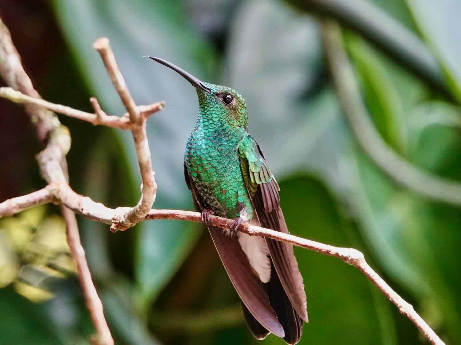
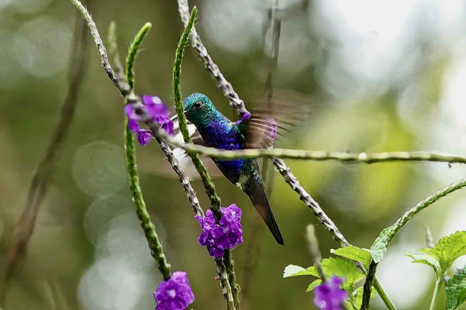
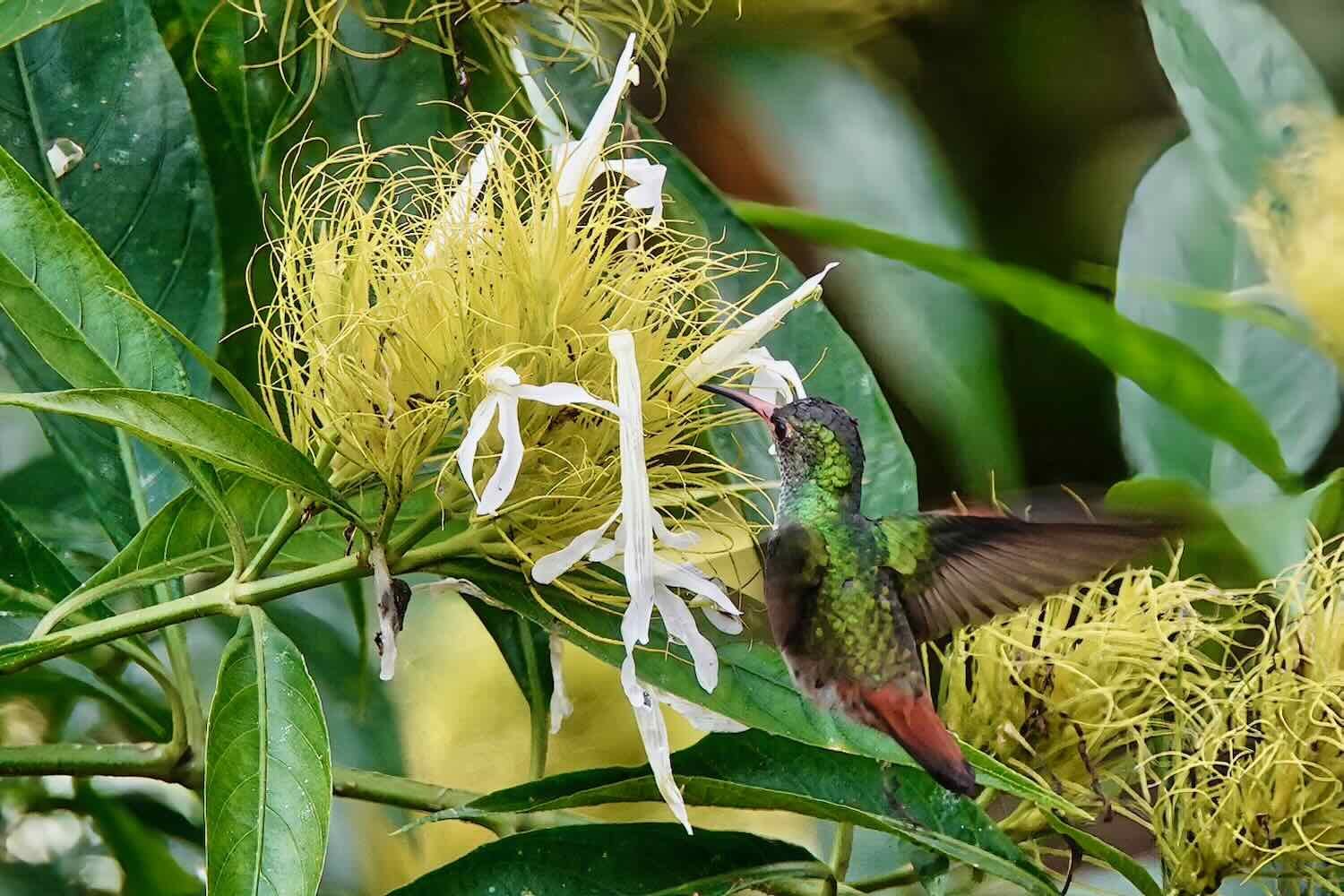
Colombia is renowned for its diversity of hummingbirds. In fact, with 165 recorded species, Colombia has the most species of hummingbirds of any country in the world. We saw three different species of the little forest jewels at the botanic gardens.
Among the butterflies visiting the flowers was this eleuchia longwing. San Jorge Botanic Garden, Ibagué, Tolima Department, Colombia. Copyright © 2019-2024 Pedals and Puffins.
We even spotted a couple of mammals, like this black agouti munching on a guava fruit. San Jorge Botanic Garden, Ibagué, Tolima Department, Colombia. Copyright © 2019-2024 Pedals and Puffins.
Several Weeks of Festivals
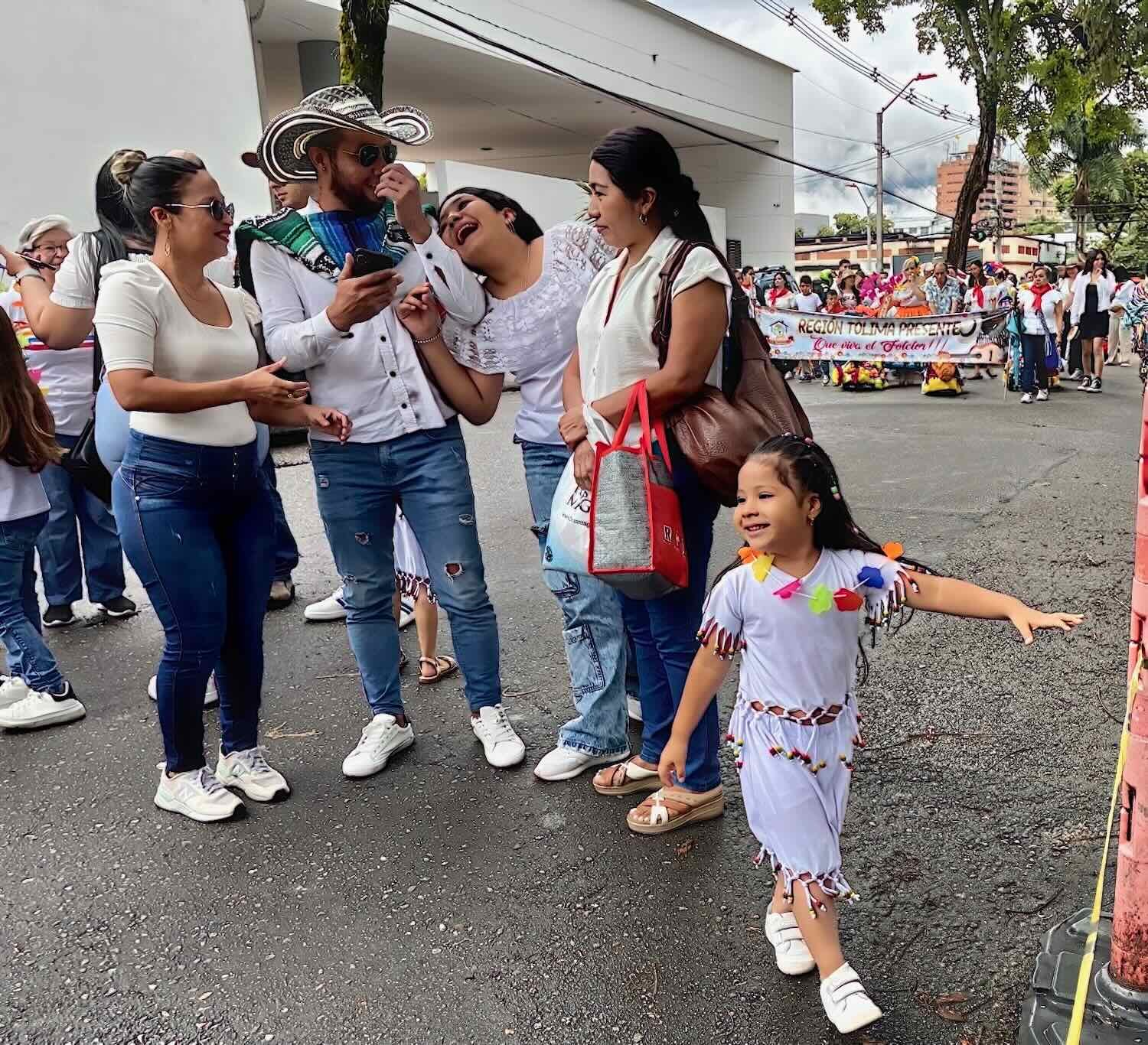
However, the reason we lingered in Ibagué so long was so that we could enjoy the 50th Annual Colombian Folk Festival. The event officially spans three weeks in June, with activities building in size and extravagance each week. During the first weekend, we observed a couple of low-key events, including a parade for school groups and a children’s parade.
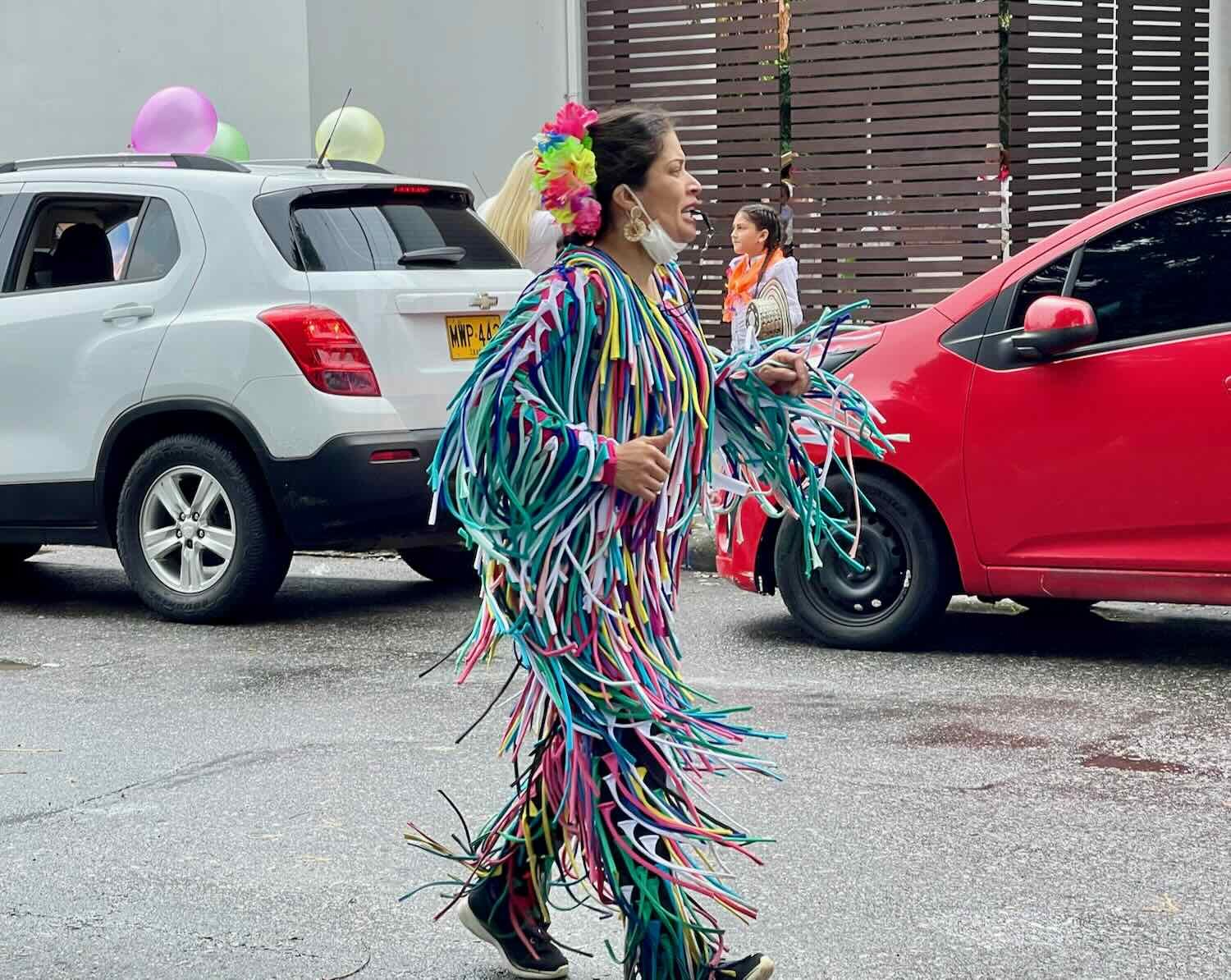
This float was getting prepped for the school parade. The masked character in colored rags is a matachine, a folk creature with origins in pre-Colombian, indigenous rituals. Although they can be fearsome looking beasts, modern matachines are associated with healing and protection from the Devil. Colombian Folk Festival, Ibagué, Tolima Department, Colombia. Copyright © 2019-2024 Pedals and Puffins.
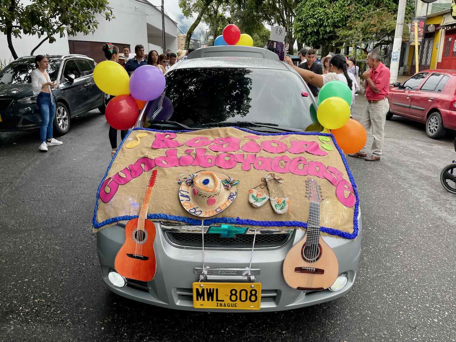
Most parade floats had symbols associated with indigenous cultures and nature. Copyright © 2019-2024 Pedals and Puffins.
Wild animal masks were especially popular images. Copyright © 2019-2024 Pedals and Puffins.
A jaguar bared its teeth on the side of another parade float. Copyright © 2019-2024 Pedals and Puffins.
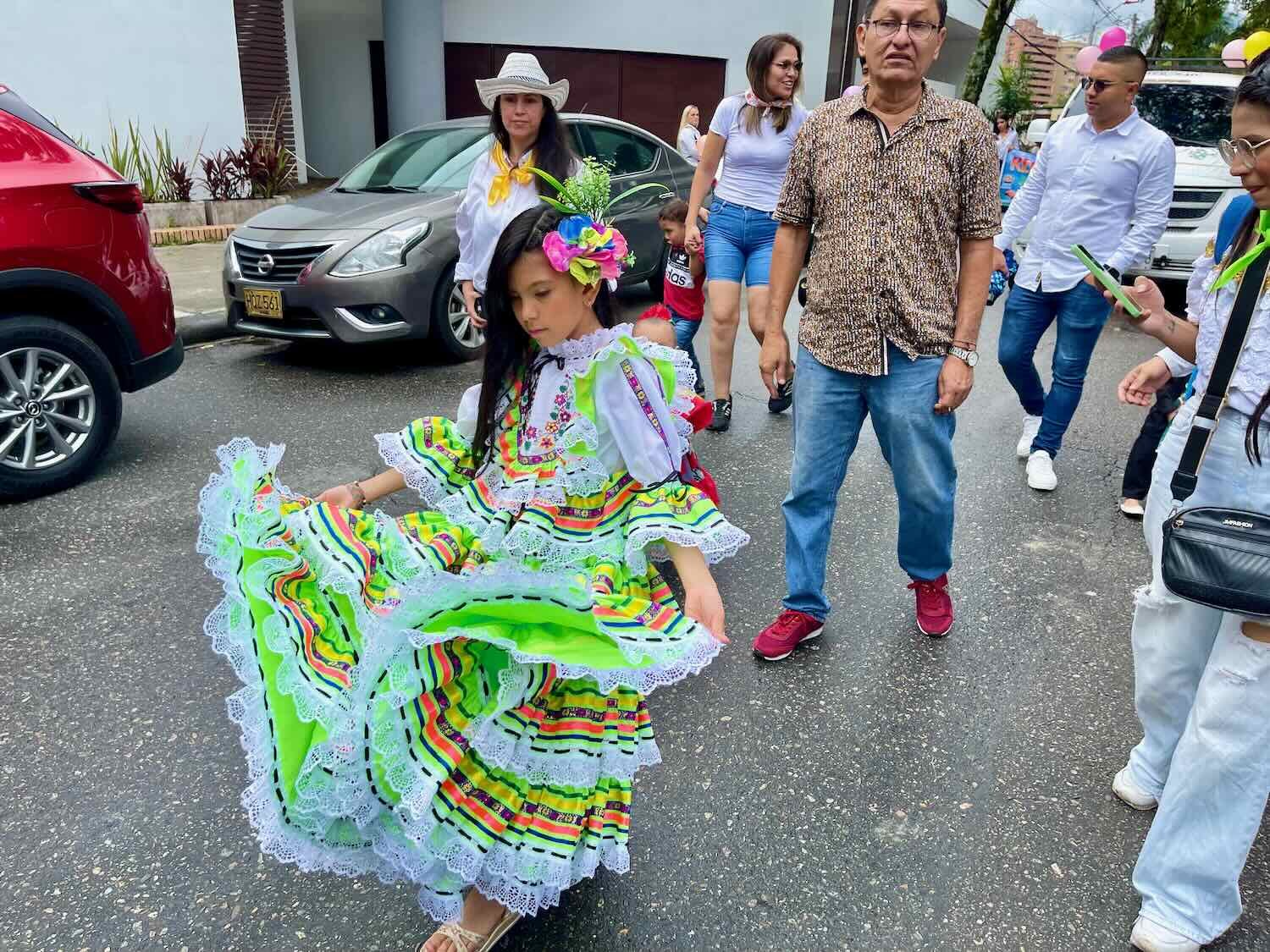
For the children’s parade, groups of little kids representing different regions of Colombia dressed up in folk costumes. This duo represented the region of Jardín. Colombian Folk Festival, Ibagué, Tolima Department, Colombia. Copyright © 2019-2024 Pedals and Puffins.
During the first week we saw an artist working on this mural. Colombian Folk Festival, Ibagué, Tolima Department, Colombia. Copyright © 2019-2024 Pedals and Puffins.
By the end of the week, the painting was complete. Colombian Folk Festival, Ibagué, Tolima Department, Colombia. Copyright © 2019-2024 Pedals and Puffins.
Many of the days during the Colombian Folk Festival are designated for celebrating a specific custom, including Hat Day. On most festival days, the hat vendors were out in force, selling a variety of sombreros made in traditional Colombian styles - particularly the black-and-white Sombrero Vueltiao. Colombian Folk Festival, Ibagué, Tolima Department, Colombia. Copyright © 2019-2024 Pedals and Puffins.
A Fiesta for Pets
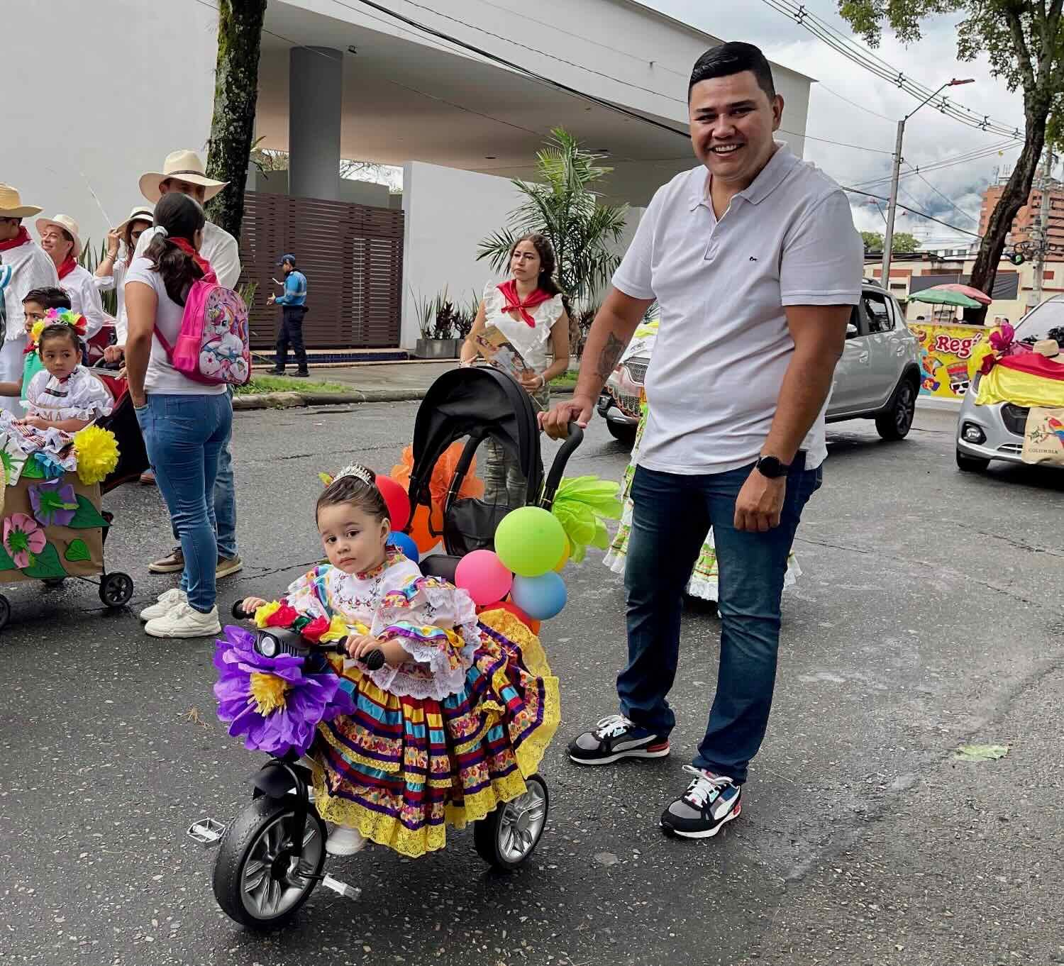
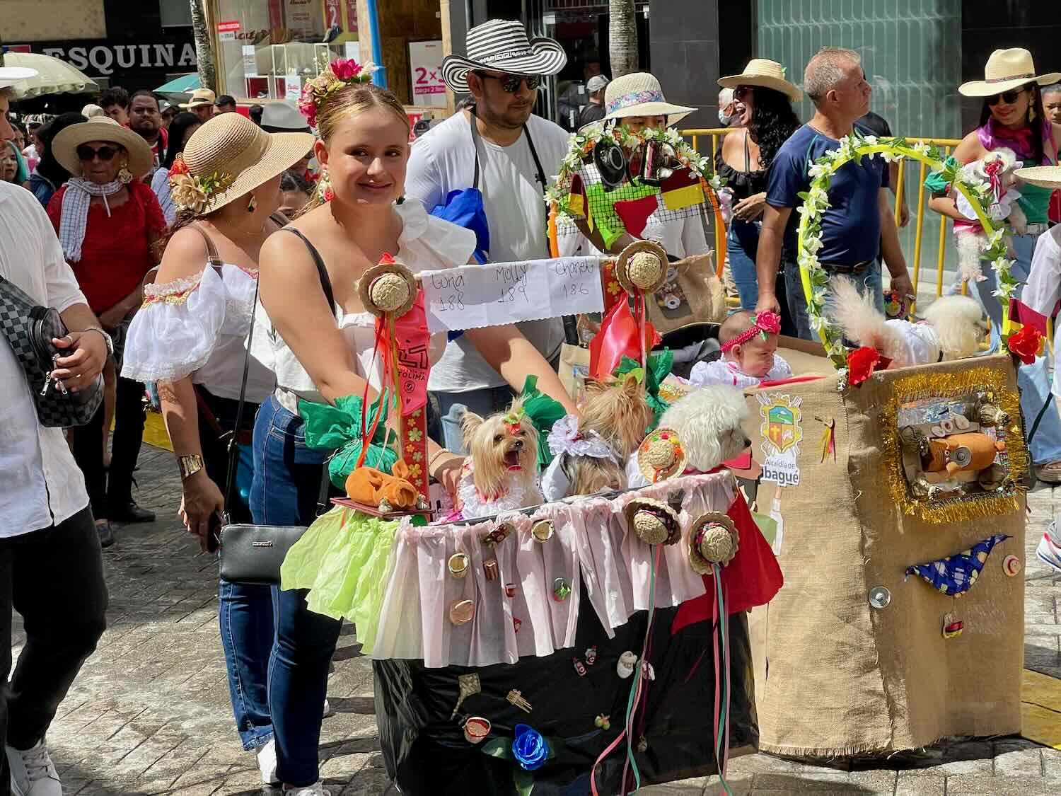
One Saturday morning we stumbled upon a parade for pets and their owners. At first we saw just a few people walking their dogs down the middle of the pedestrian street - but we couldn’t help notice that all of the dogs were dressed up in outfits - the lady dogs had frilly skirts and straw hats with flowers, and the gentlemen dogs had white shirts and red scarves. As we watched, they kept coming, until it was obvious this was more than just a couple of folks out for a walk with their pets. Pretty soon we were passed by several hundred people marching with their pets (mostly dogs, but also a few cats and the occasional pig). The national police even came out with their service dogs.
A woman pushes her three little princesses in a stroller decorated for the pet parade. Colombian Folk Festival, Ibagué, Tolima Department, Colombia. Copyright © 2019-2024 Pedals and Puffins.
The working dogs were very well behaved. Copyright © 2019-2024 Pedals and Puffins.
This dog was dressed up as a matachine. Copyright © 2019-2024 Pedals and Puffins.
This owner gave his little friend a lift. Copyright © 2019-2024 Pedals and Puffins.
The Grand Parade of San Juan
On the second weekend, Ibagué hosted a big parade to celebrate the Festival of San Juan. Dating back to the era before the arrival of the Spanish, the festival was originally a celebration of the summer solstice, with games, feasting, and rituals to chase away evil spirits. Later, Christian missionaries layered the birth of St. John the Baptist onto the existing rituals, resulting in new traditions like dances that depict indigenous matachine spirits protecting the Virgin Mary from the Devil.
However, by far the three most ubiquitous components of the parade were (1) couples dancing either the Cumbia or Bambuco (both Colombian folk dances), (2) groups dressed like Native South American warriors, and (3) princesses waving to the crowd from floats. Every town in the region and many other parts of the country were represented in the parade by a group of performers. And all of the local neighborhoods had elected a ‘princess’ as their ambassador to the parade. That assured that people from all over the region and the country would have a reason to come to Ibagué to celebrate and watch the parade.
The parade itself was an impressive event, with thousands of participants and lasting more than three hours. Even a steady (but mostly light) rain didn’t dampen the spirits of the performers.
Many of the groups performed the Cumbria, Colombia’s national dance. Here, a couple of Cumbria dancers strike a pose. Grand Parade of San Juan, Colombian Folk Festival, Ibagué, Tolima Department, Colombia Copyright © 2019-2024 Pedals and Puffins.
The Cumbria is a ‘romantic’ style of dance, with couples swirling past each other, big frilly skirts, and joyful music. Grand Parade of San Juan, Colombian Folk Festival, Ibagué, Tolima Department, Colombia. Copyright © 2019-2024 Pedals and Puffins.
Native South American ‘warrior’ costumes were also really popular. Grand Parade of San Juan, Colombian Folk Festival, Ibagué, Tolima Department, Colombia. Copyright © 2019-2024 Pedals and Puffins.
Every neighborhood of Ibagué and many other towns throughout Colombia were represented by their princesses, waving to the crowd from the heights of elaborate floats. Grand Parade of San Juan, Colombian Folk Festival, Ibagué, Tolima Department, Colombia. Copyright © 2019-2024 Pedals and Puffins.
It took the city a week to set up rows of bleachers all along the parade route. On parade day, they were all packed with viewers. Grand Parade of San Juan, Colombian Folk Festival, Ibagué, Tolima Department, Colombia. Copyright © 2019-2024 Pedals and Puffins.
The parade went ahead, in spite of the fact that it was a pretty rainy day. We had gone out without our raincoats, but were able to snag a couple of rain ponchos from an enterprising vendor. Grand Parade of San Juan, Ibagué, Tolima Department, Colombia. Copyright © 2019-2024 Pedals and Puffins.
Vendors roasted meat and boiled vats of soup over open wood fires. They built their fires directly in the road, taking up a full lane. Ibagué, Tolima Department, Colombia. Copyright © 2019-2024 Pedals and Puffins.
Elaborate kitchens like this one were set up the day before. But by 5pm in the evening after the parade, most had disappeared. Ibagué, Tolima Department, Colombia. Copyright © 2019-2024 Pedals and Puffins.
Here are a few more of our favorite images from the San Juan Parade:

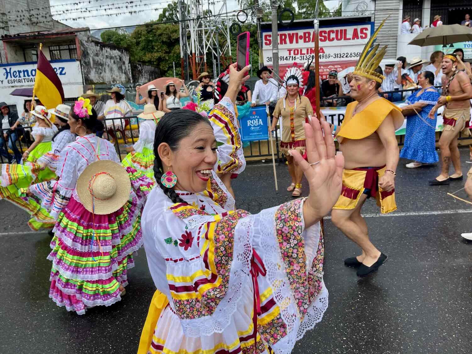
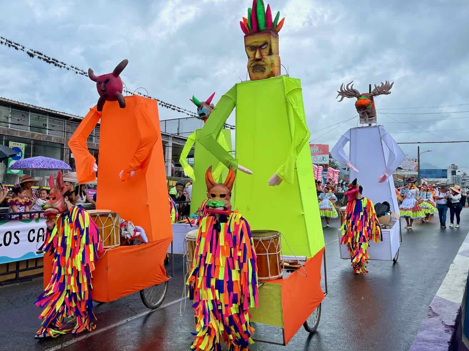
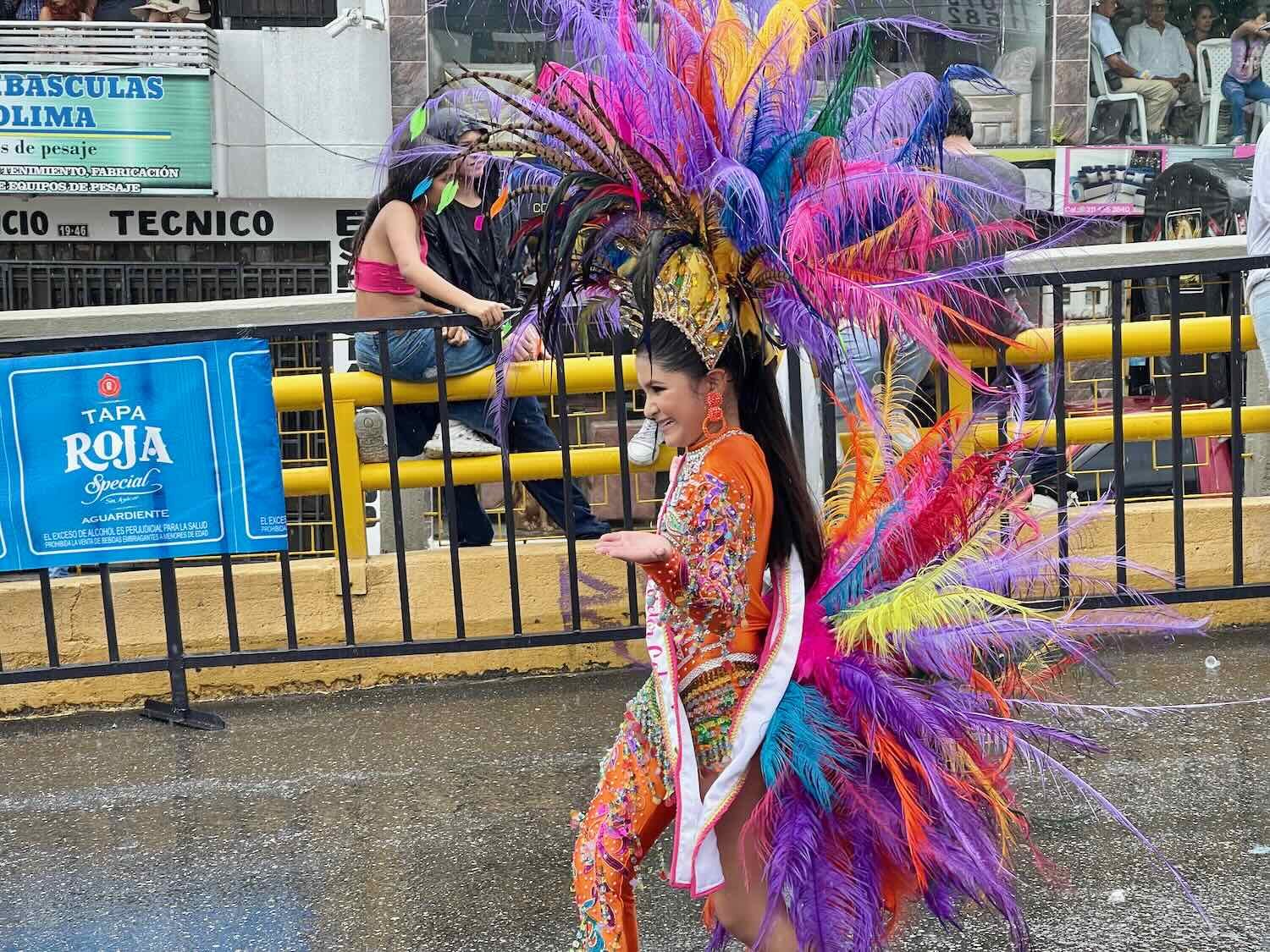
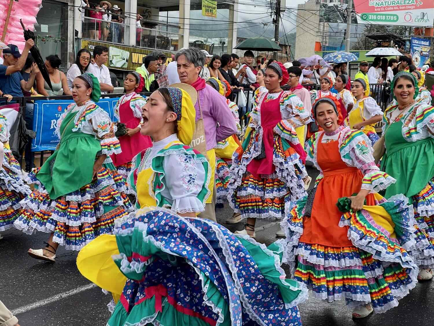
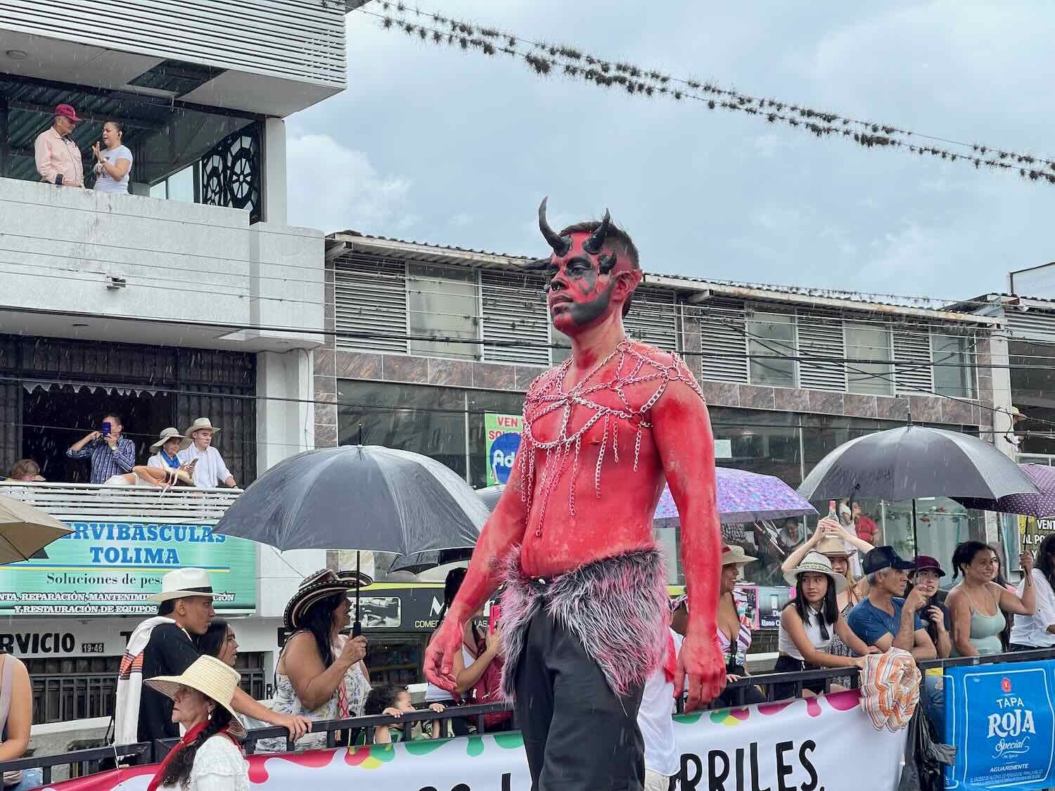
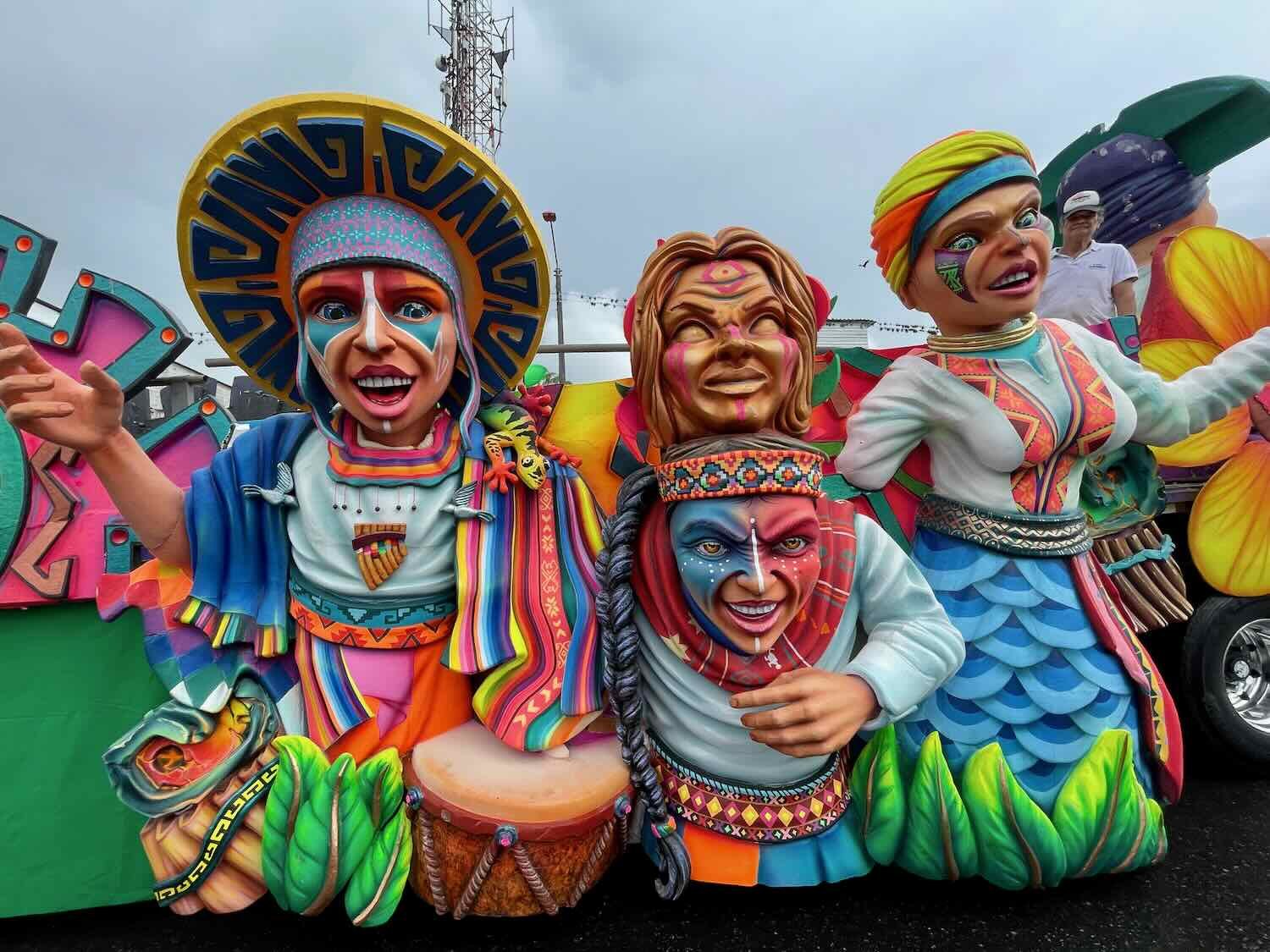
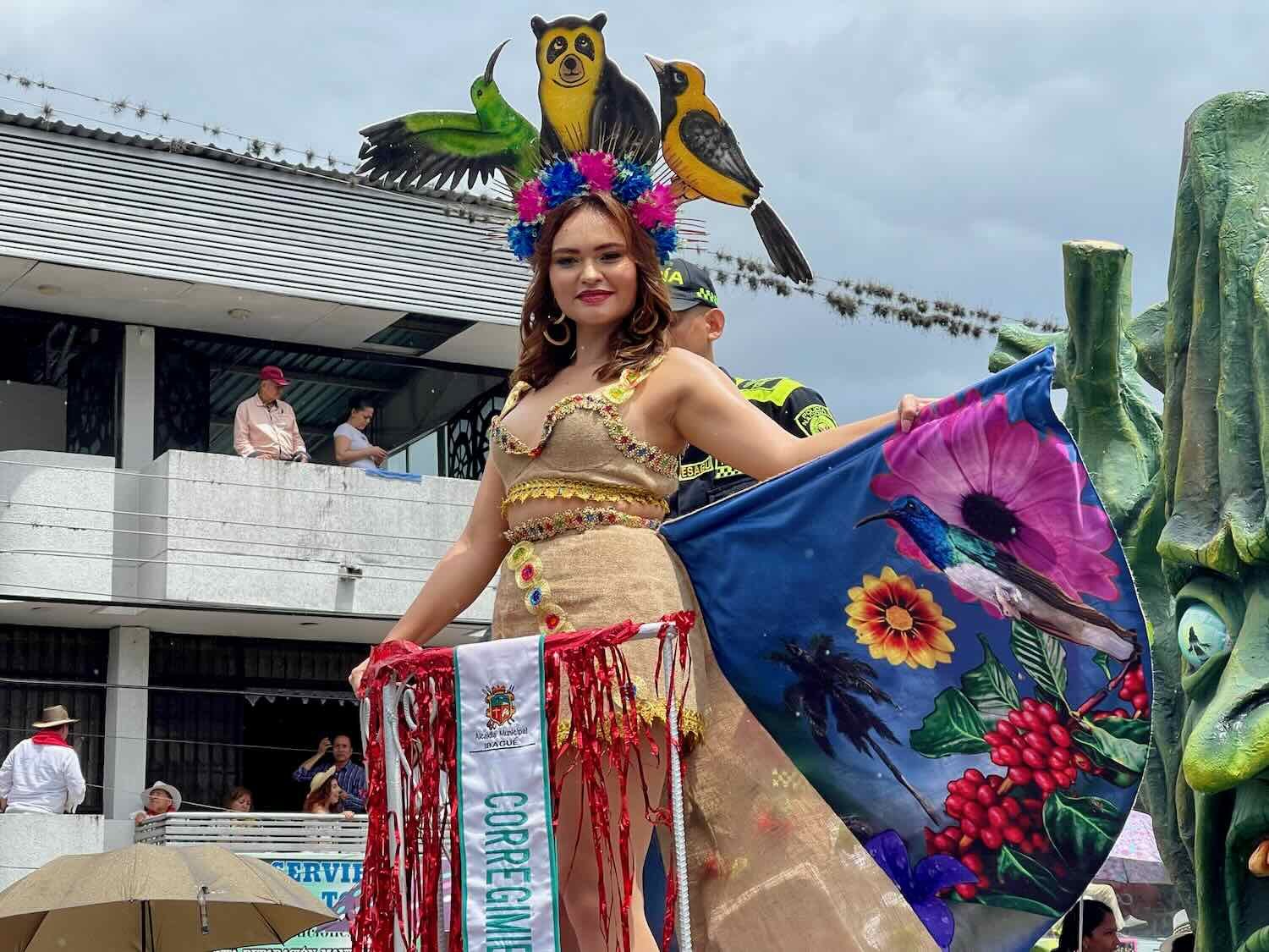
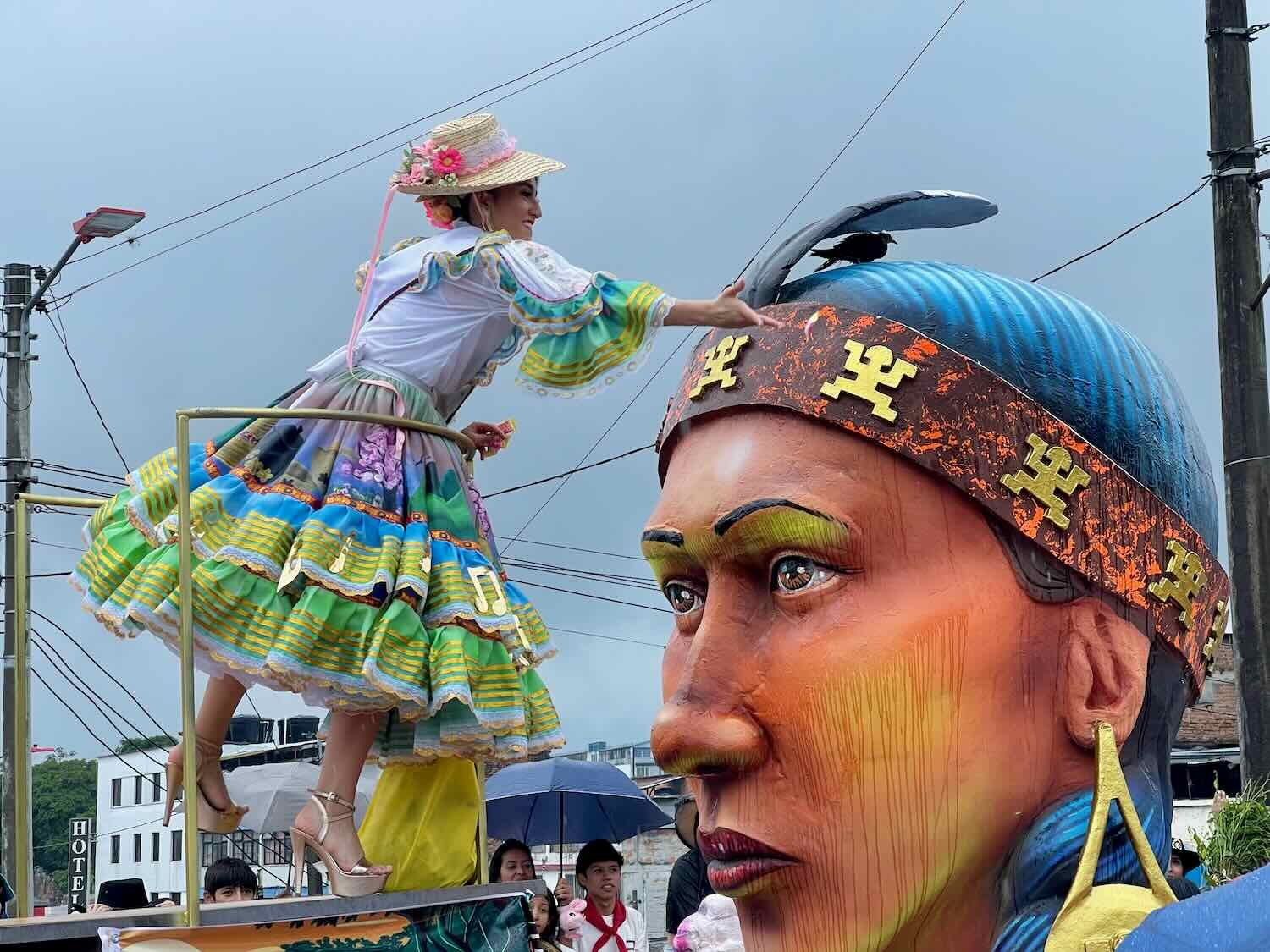
The Festival of San Pedro
As grand as it was, the Parade of San Juan was not the biggest event of this holiday season. The very next weekend Ibagué was home to one of the most lavish parties of the year - the Festival of San Pedro. This festival is celebrated throughout Colombia, and is especially important in the south-central part of the country where Ibagué sits. Our first indication that this was a massive celebration came when we realized we wouldn’t be able to get hotel reservations on short notice anywhere in the region on that weekend. So we stayed put in Ibagué, where a last-minute hotel cancellation at the place where we were staying allowed us to remain. Then we waited to see what would happen.
The day before the big parade, transportation enthusiasts got out their vintage bicycles, motorbikes and cars to promenade through the streets in period costume. It was fun to see all the old bikes with features like sissy bars and banana saddles.
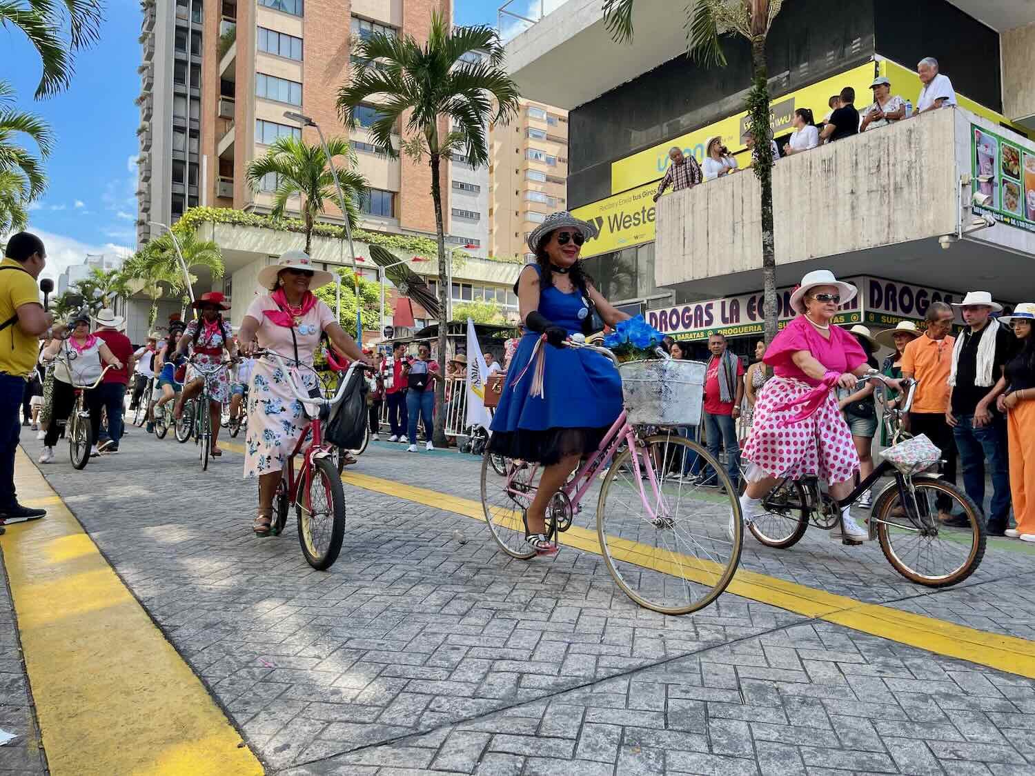
The bicycle group led the parade. We got a kick out of seeing all the ‘heirloom’ bicycles still out on the road. Festival of San Pedro, Ibagué, Tolima Department, Colombia. Copyright © 2019-2024 Pedals and Puffins.
This vintage Fiat oozed personality. Festival of San Pedro, Ibagué, Tolima Department, Colombia. Copyright © 2019-2024 Pedals and Puffins.
A 1955 Ford Mercury carried these ladies in style. Festival of San Pedro, Ibagué, Tolima Department, Colombia. Copyright © 2019-2024 Pedals and Puffins.
The day of the big parade, the city was absolutely packed with throngs of visitors. The crowds were so huge that we had trouble even walking down the road, let alone finding a spot along the 2.5 mile (4 km) parade route to get a good view. We ended up walking all the way to the end, where we found a spot along the ‘cool down’ area past the end of the official parade route. The performers were clearly tired, but many of them continued to dance and wave for the crowd gathered there. We enjoyed seeing this slightly more personal side of the parade.
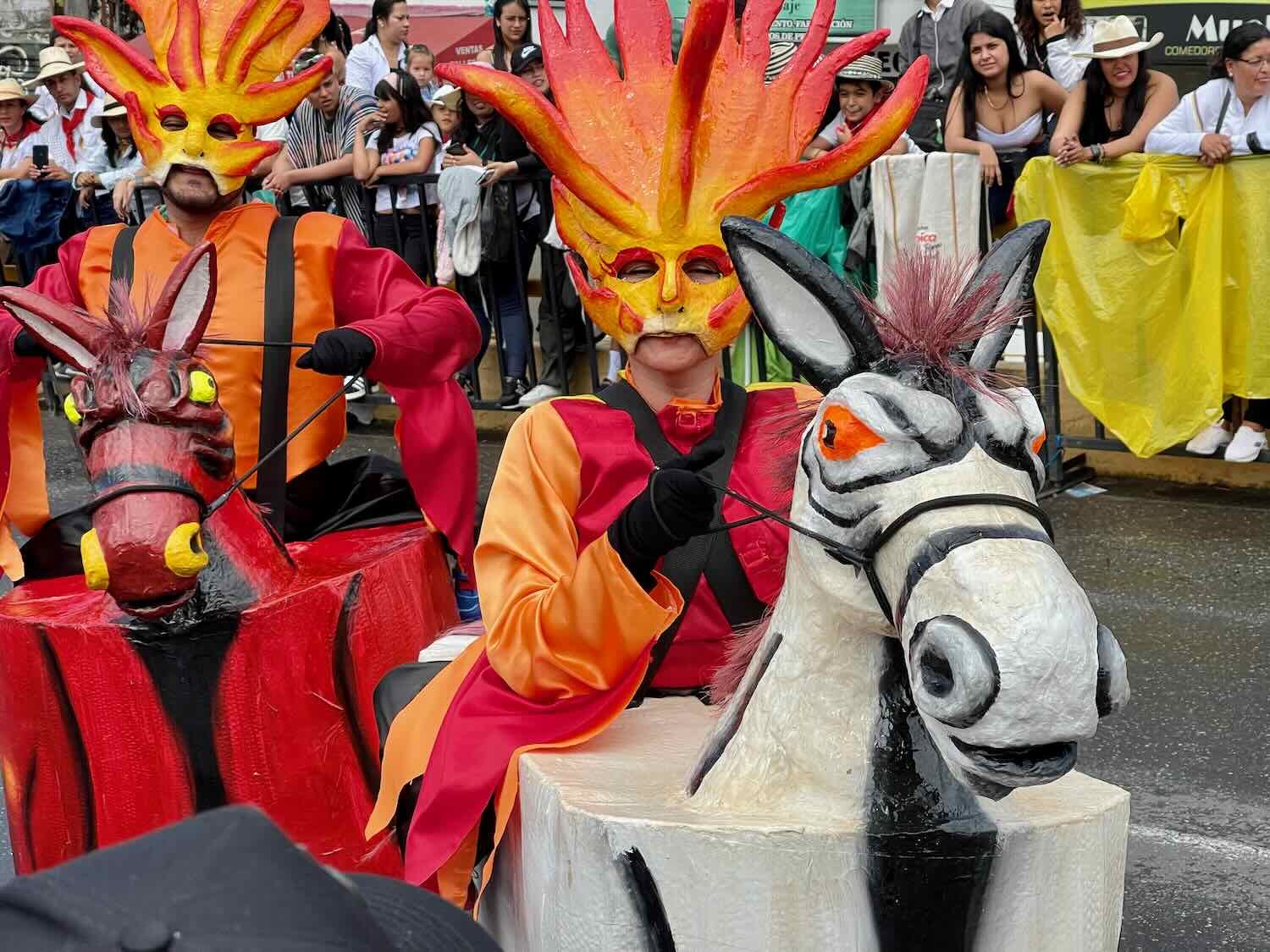
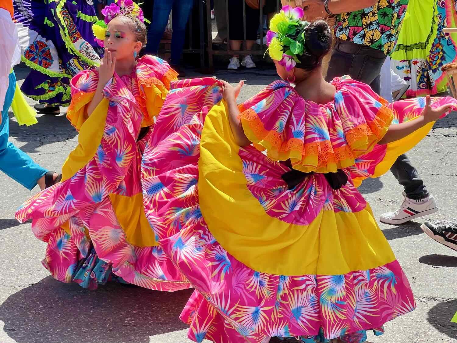
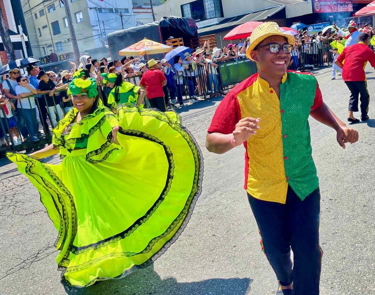

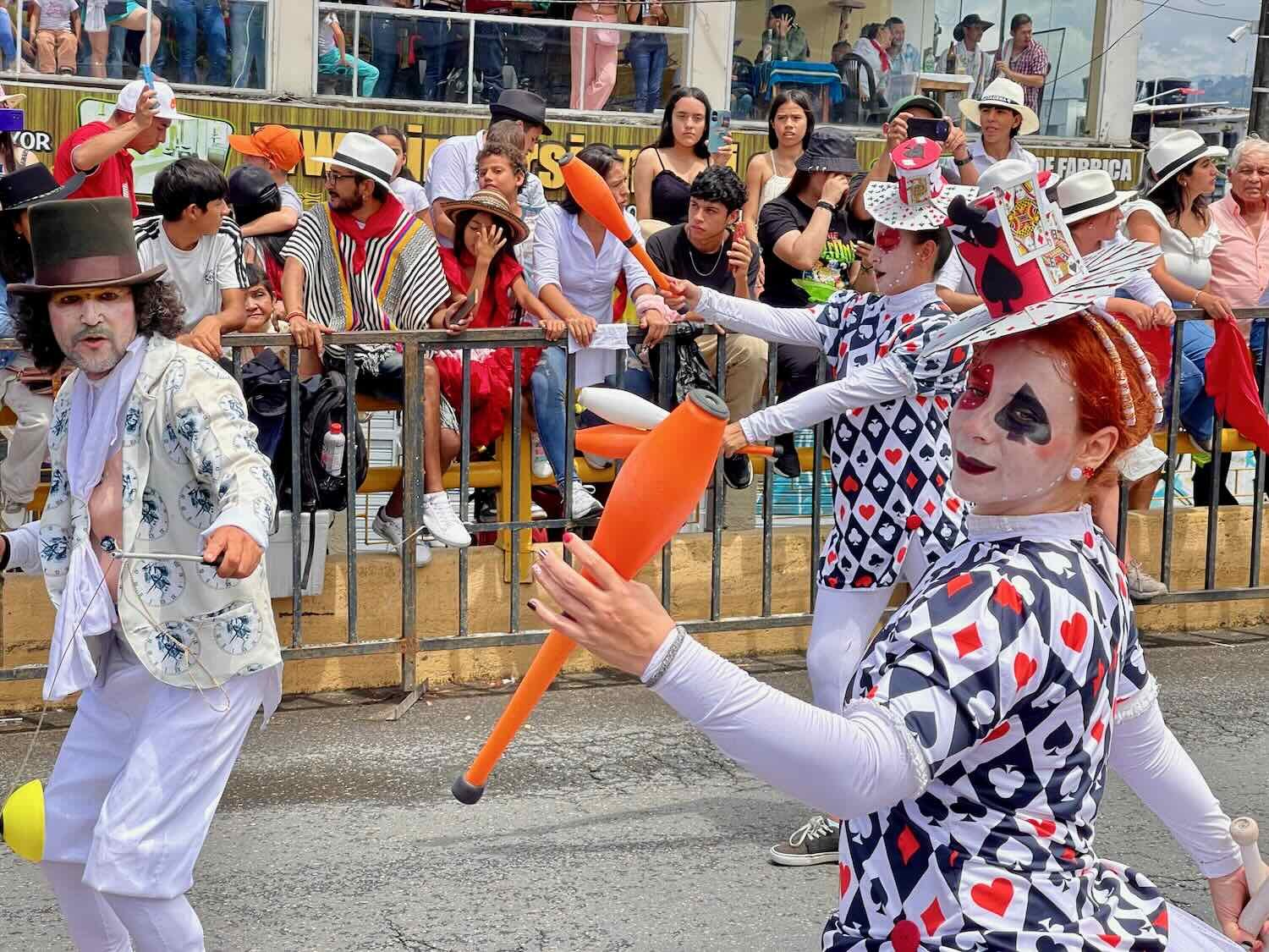
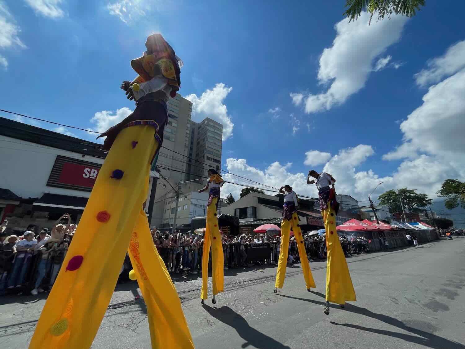
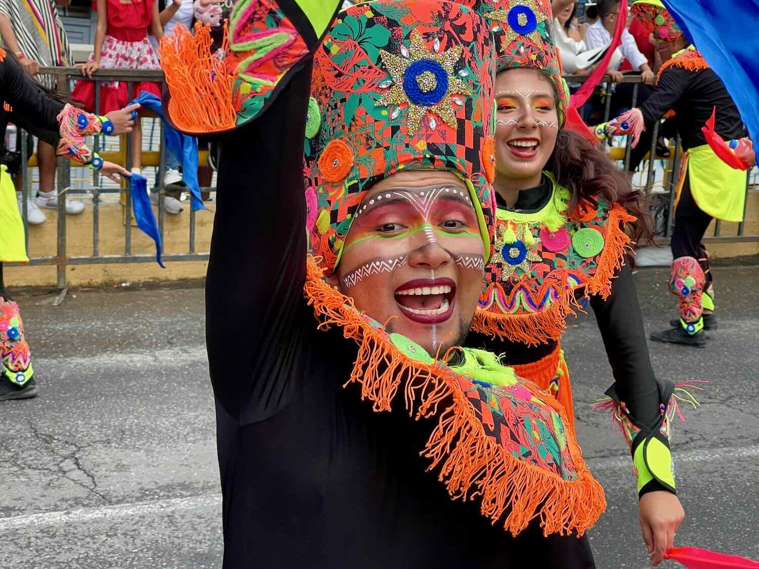
One of the parade floats had a cyclist wearing the Tour de France’s polka-dot King of the Mountains jersey. Colombians are huge professional cycling fans, and are very competitive in the big international races like the Tour de France. Festival of San Pedro, Ibagué, Tolima Department, Colombia. Copyright © 2019-2024 Pedals and Puffins.
About a dozen people had walked the entire route carrying heavy flower arrangements that honored the parade’s sponsors. They looked really exhausted at the end. Some folks on the side of the road offered this guy a swig of some alcohol from their bottle. Festival of San Pedro, Ibagué, Tolima Department, Colombia. Copyright © 2019-2024 Pedals and Puffins.
The next morning the crowds had disappeared and streets were deserted - except for a few workers on the clean up crew. This guy was disassembling one of the many temporary, wooden vendor stalls. Festival of San Pedro, Ibagué, Tolima Department, Colombia. Copyright © 2019-2024 Pedals and Puffins.
From the Mountains to the Desert
After the big parties in Ibagué, we were ready to get back on our bicycles. We would leave our high-altitude, mountain adventures behind, and drop down another 3,000+ feet (1,000 m) into the Magdalena River Valley - an ancient route from the Caribbean into the heart of the South American continent. The Andes Mountains border the valley on both the east and west, wringing moisture from the air. That makes the Magdalena River Valley one of the drier parts of Colombia. Before long we might even see some cacti. After several soggy weeks in the Andes mountains, that sounded like something we would enjoy.